

19.11.2026 | Jochen Bettzieche | SLF News
Keeping an eye on the avalanche situation – now in detail for your own region: from winter 2026/27, the WSL Institute for Snow and Avalanche Research SLF will provide daily information on avalanche danger, snowpack and weather for each of Switzerland's 149 warning regions individually. This means that anyone planning a ski tour or responsible for the safety of roads and railway lines can immediately see the forecast situation in their local area. Additional forecasts looking two days ahead make planning easier.
- Avalanche bulletin 2026/27: detailed information for each of Switzerland's 149 warning regions.
- Local avalanche danger: the zoom function shows where the danger is especially high and which avalanche problems prevail.
- Plan ski tours earlier: avalanche forecasts now also cover the day after tomorrow.
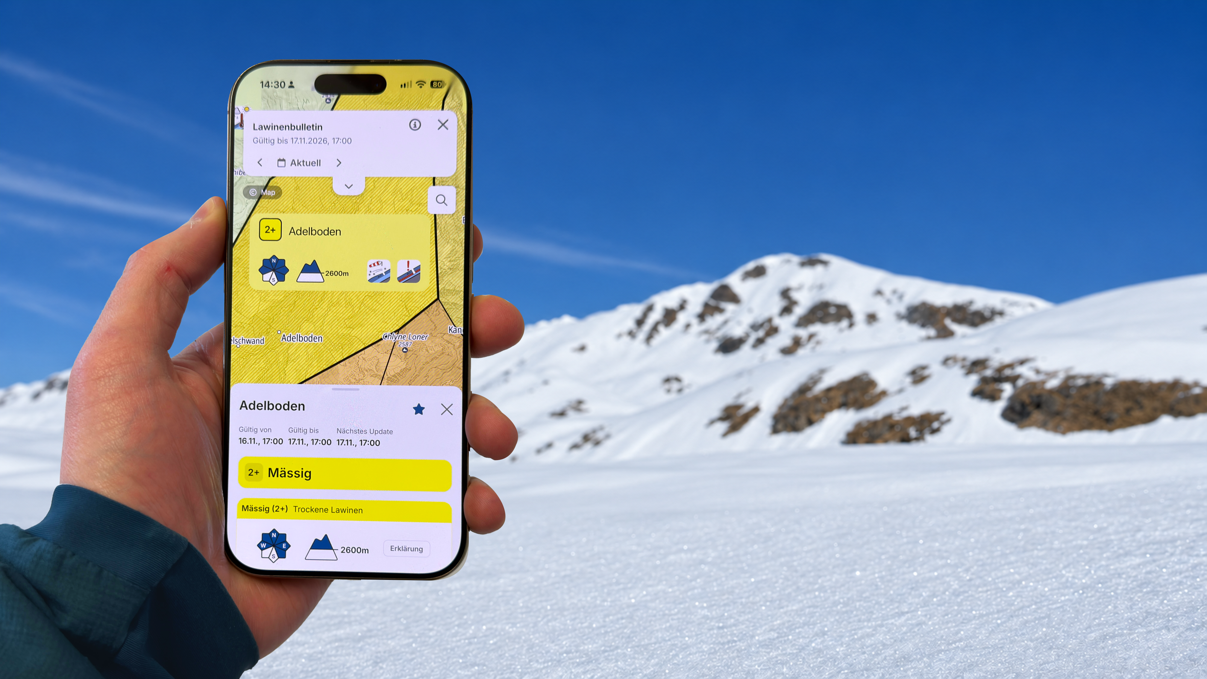
The avalanche bulletin is becoming more regional. From the start of the 2026/27 season, the Avalanche Warning Service (AWS) will prepare all the information in the avalanche bulletin for each individual warning region (see box). "Switzerland is home to 149 warning regions, and we are now providing detailed information for each of them," says Kurt Winkler, avalanche forecaster at the SLF. You can zoom in on your region (see image gallery).
Those who want to find out about the current avalanche situation can consult a more detailed description of the conditions in the areas relevant to them. Anyone planning a ski tour in Adelboden can look at precisely this region; they no longer have to rely on more general information covering a wider area. "In future, the bulletin will also describe the structure of the snowpack more precisely at local level," says Winkler. Until now, a single text described the structure of the snowpack for the whole of Switzerland. Now a description is provided for each individual warning region. The revamped avalanche bulletin also gives those responsible for natural hazards at cantonal and municipal level a better basis for their work, such as when they have to decide whether to close a road or a railway line.
Avalanche danger in detail 
Using the new zoom function, users can visualise the regional situation quickly and clearly. The overview map also uses hatching to show the intermediate levels developed by the SLF in 2022. These indicate whether a given danger is in the lower, middle or upper range of a danger level. In addition, graphic symbols show which slope aspects and which elevations are likely to be particularly hazardous. If you zoom in even closer, you can see which avalanche problems are the most prevalent, such as wind slab or weak layers deep in the old snowpack.
The forecasts looking two days ahead are another new feature. This allows winter sports enthusiasts to see at a glance what the weather will be like and how high the avalanche danger is likely to be, explains Winkler: "This means ski tourers can already see on Friday evening, for example, whether they would be better off going on a tour on Saturday or Sunday."
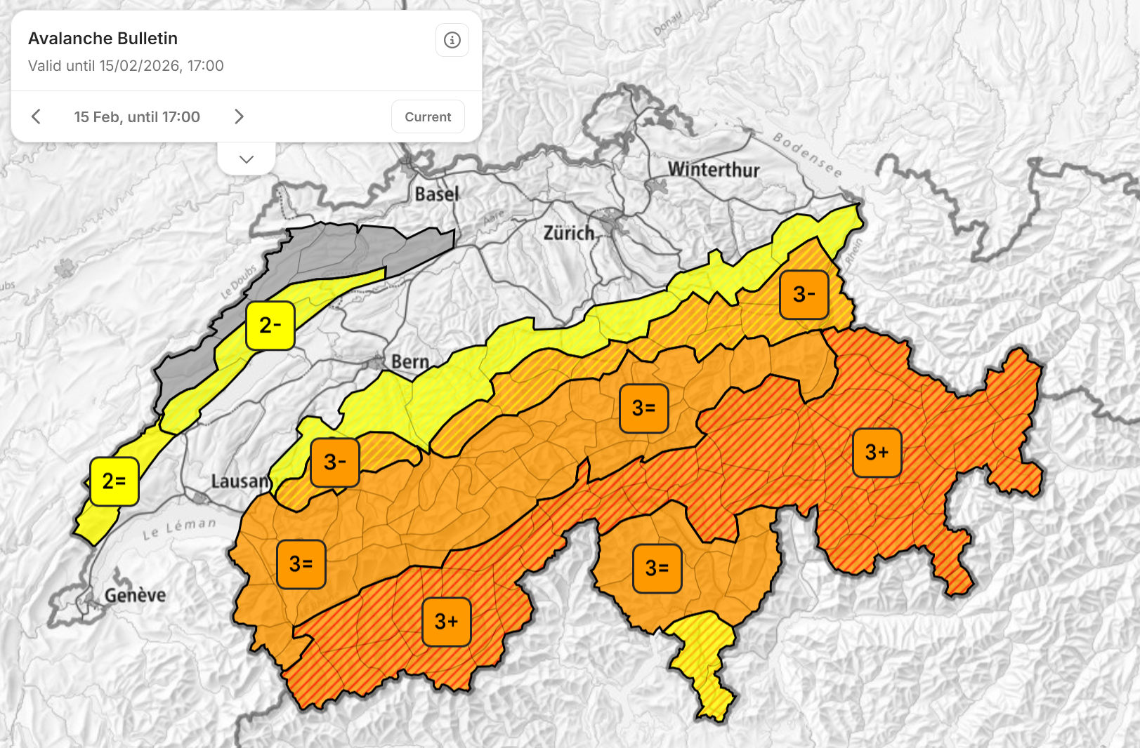
The danger map now also shows the intermediate danger levels. Areas with the same characteristics are outlined by a thicker black line. (Picture: Kurt Winkler / SLF)
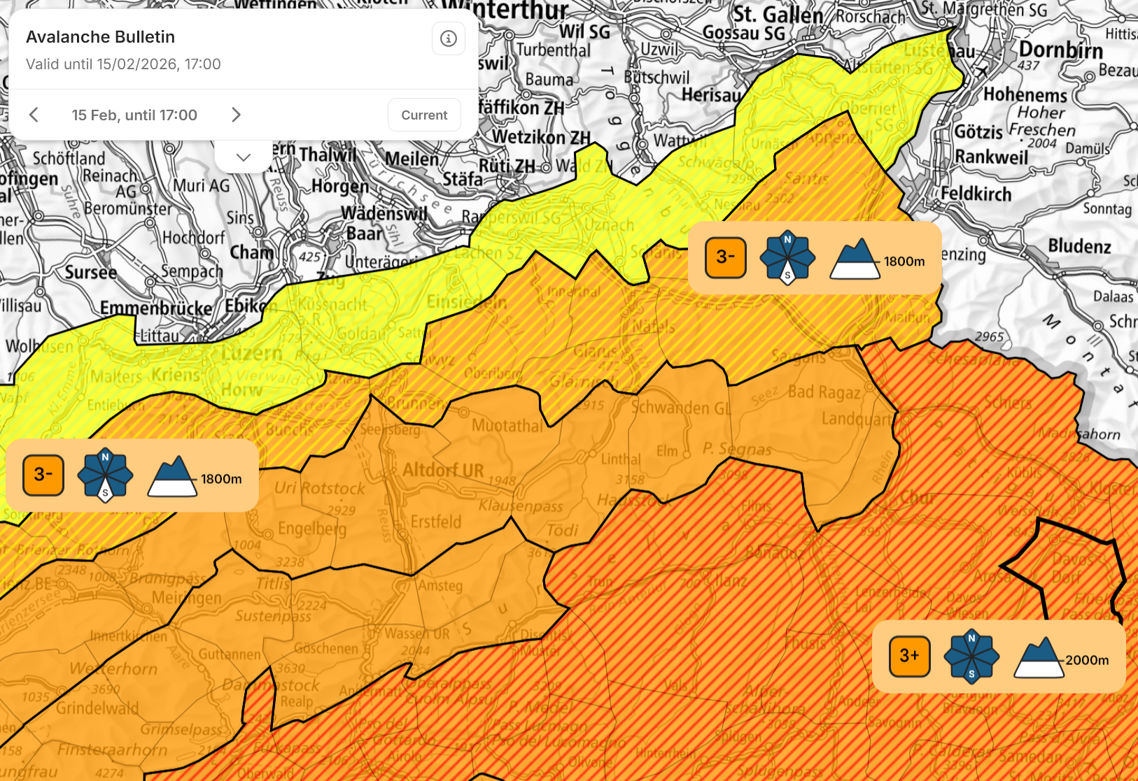
Zooming in reveals the aspects and elevations most affected … (Picture: Kurt Winkler / SLF)
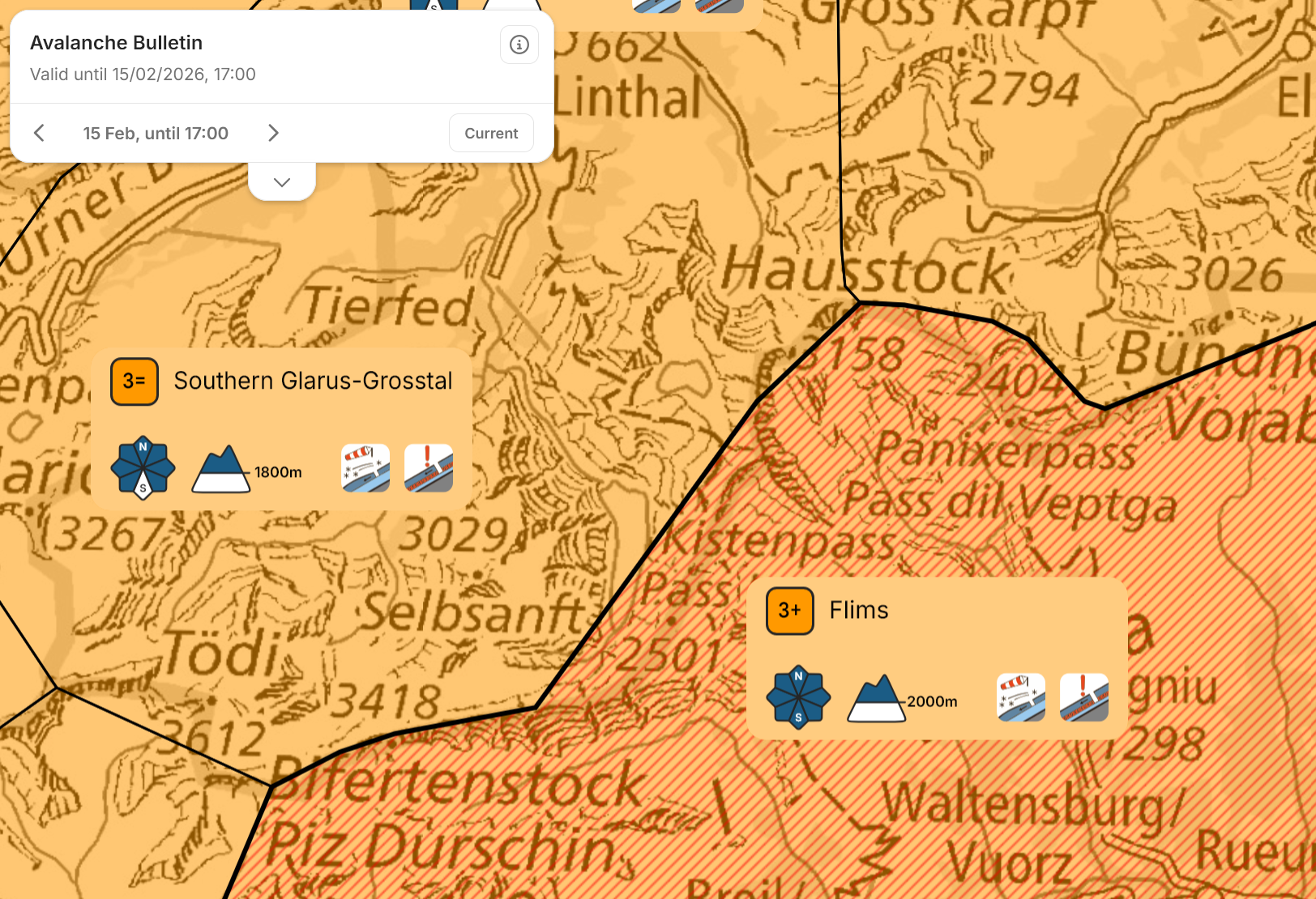
… and the avalanche problems. (Picture: Kurt Winkler / SLF)
Weather and new fallen snow for your own region 
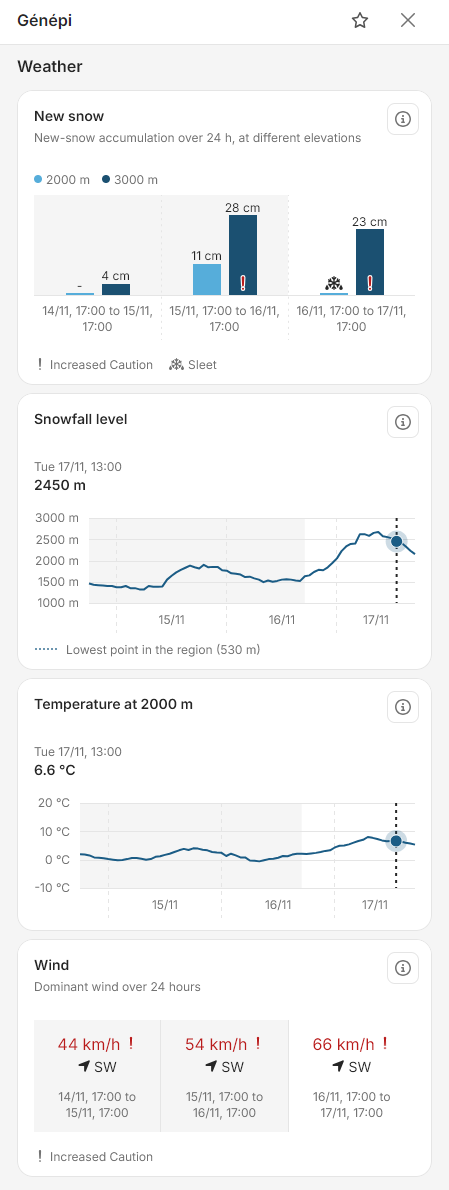
A regional weather forecast is also displayed for the individual warning regions. MeteoSwiss supplies forecasts for the temperature profile and wind. The Operational Snow-Hydrological Service at the SLF provides information on volumes of new snow. A red exclamation mark highlights critical wind speed values and heavy new snowfall. A graph illustrates how the snowfall limit has changed over time. "For key parameters such as new snow and wind in particular, reliable values are now clearly presented and available for the desired warning region," says Winkler.
Moreover, the bulletin now includes a calendar showing how dangers have developed over the course of the winter. "This is a service for those who want to take a closer look at how weather and avalanche conditions are connected," says Winkler.
What are … warning regions?
The whole of Switzerland is divided into 149 warning regions, from Geneva in the west to Val Müstair in the east, and from Basel in the north to Mendrisiotto in the south. All federal agencies specialising in natural hazards, such as MeteoSwiss, the Federal Office for the Environment (FOEN) and the Swiss Seismological Service (SED), use this division for their forecasts, as does the SLF’s Avalanche Warning Service. It is important to note that there are no clearly defined boundaries between two regions with different danger assessments; instead, there are transitional areas that are in some cases kilometres wide. These often cannot be clearly assigned to either danger situation.
Links 
- More information on the new avalanche bulletin can also be found in the Avablog dated 19 November 2026
- Avalanche bulletin and snow situation
- Avalanche Warning Service
- Operational Snow-Hydrological Service (OSHD)
- Further details on the division into regions
Contact 
SLF Media Office 
Email: medien(at)slf.ch
Phone: +41 81 417 01 90
Copyright 
WSL and SLF provide image and sound material free of charge for use in the context of press contributions in connection with this media release. The transfer of this material to image, sound and/or video databases and the sale of the material by third parties are not permitted.