

08.09.2026 | Jochen Bettzieche | SLF News
What happens when water, ice and more thunder down into a valley? Researchers from SLF and ETH Zurich are investigating this using an accurate 3D model of the area around Blatten. The experiments aim to improve computer models and help to more reliably assess risks to settlements and infrastructure.
- Rock avalanches on a small scale: Researchers are investigating mass movements using a 3D model of Blatten.
- Improving the basis of computer models: Experiments show how mixtures of water, ice and rock move.
- Better assessment of natural hazards: The models are intended to show where settlements and infrastructure are at risk.
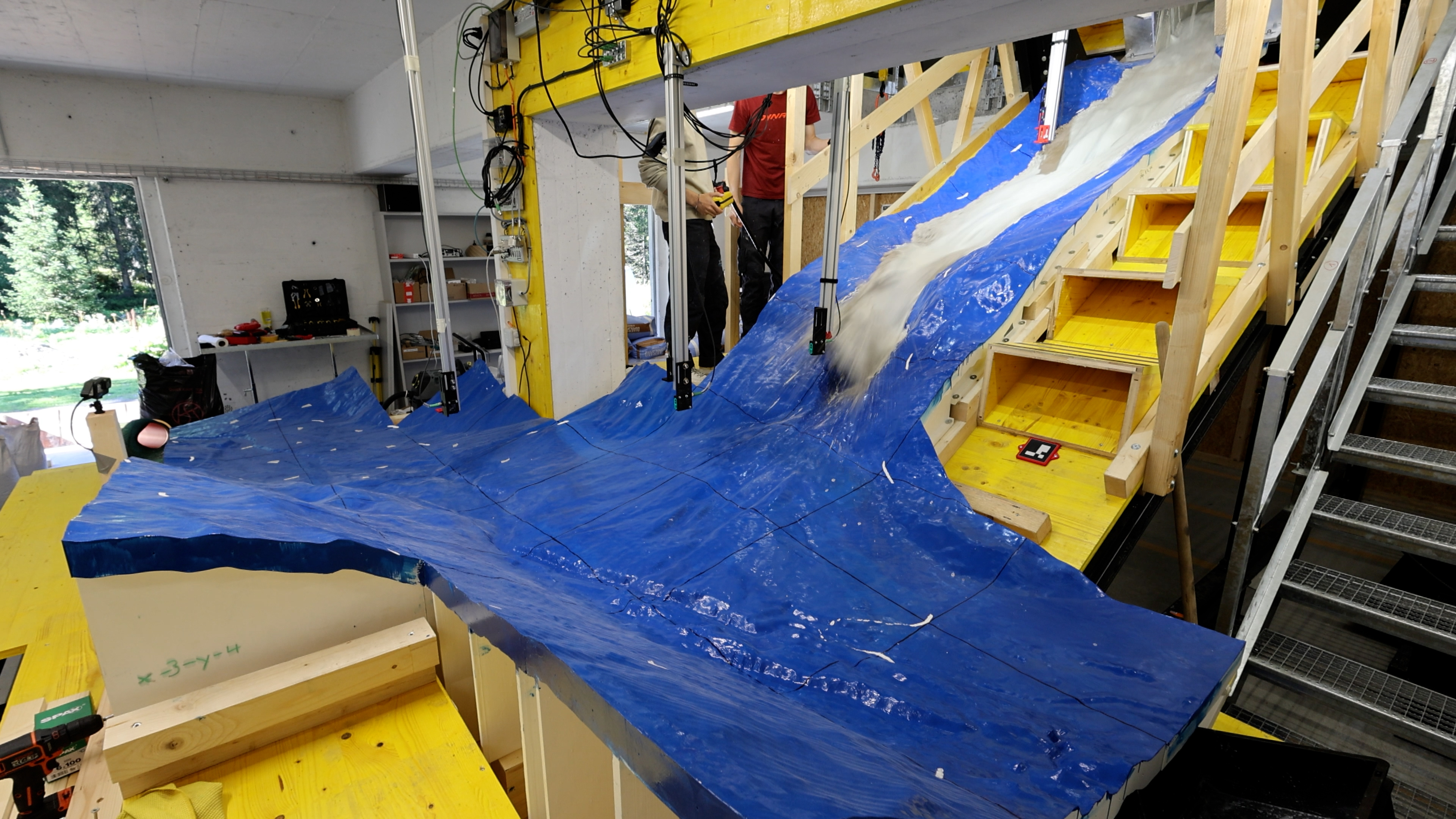
We see the Lötschental valley around Blatten, with the Birchchinn channel rising above it all the way up to Kleines Nesthorn. Everything is a gleaming blue colour. Then a hatch opens, and a mixture of water, sand and clay rushes down into the valley from the direction of Kleines Nesthorn, settling and covering vast areas. It is almost like back in 2025, when a rock avalanche almost completely destroyed and buried the village of Blatten. This time, however, it is happening in miniature, at a scale of 1:577. On a smaller scale than a model railway landscape, and without the trains. "We want to use models like this to find out how mixtures of different materials move in the natural environment," explains Johan Gaume, head of the Alpine Mass Movements research group at the WSL Institute for Snow and Avalanche Research SLF and Associate Professor of Alpine Mass Movements at ETH Zurich.
Alongside these physical models, the research group is also developing virtual ones on computers. They show scenarios describing what can happen during mass movements in the Alps, from debris flows to rock avalanches. In the future, this is intended to enable those responsible for natural hazards at cantonal and municipal levels to determine whether infrastructure or even settlements are at risk. "For these models to be reliable, they must be thoroughly tested in carefully controlled experiments," says Gaume. These are the exact experiments he is conducting on the 3D-model. Such experiments also give him key insights into how mixtures of water, ice and other materials move, what happens when they hit an obstacle, and much more.
Mass movement from the bucket 
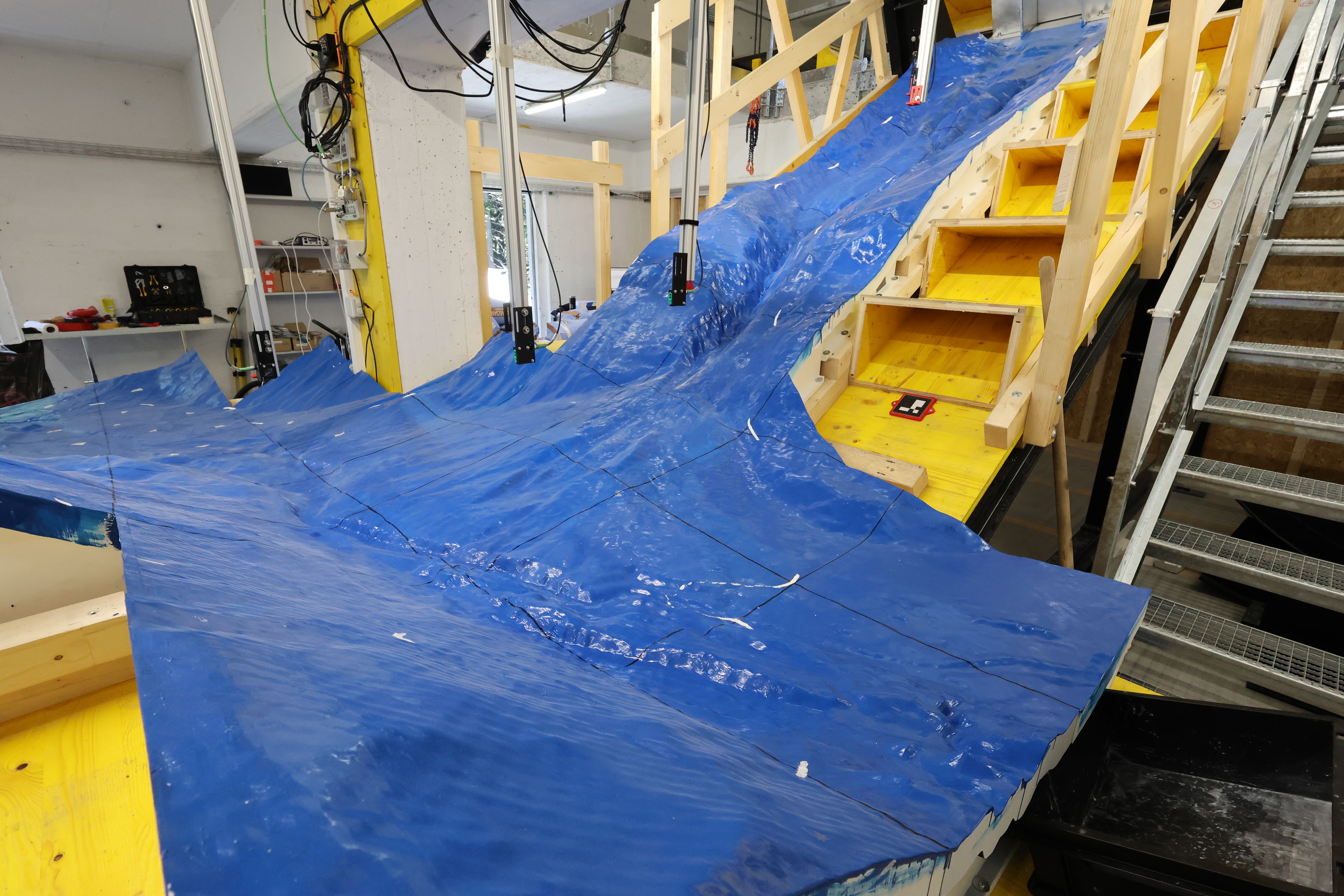
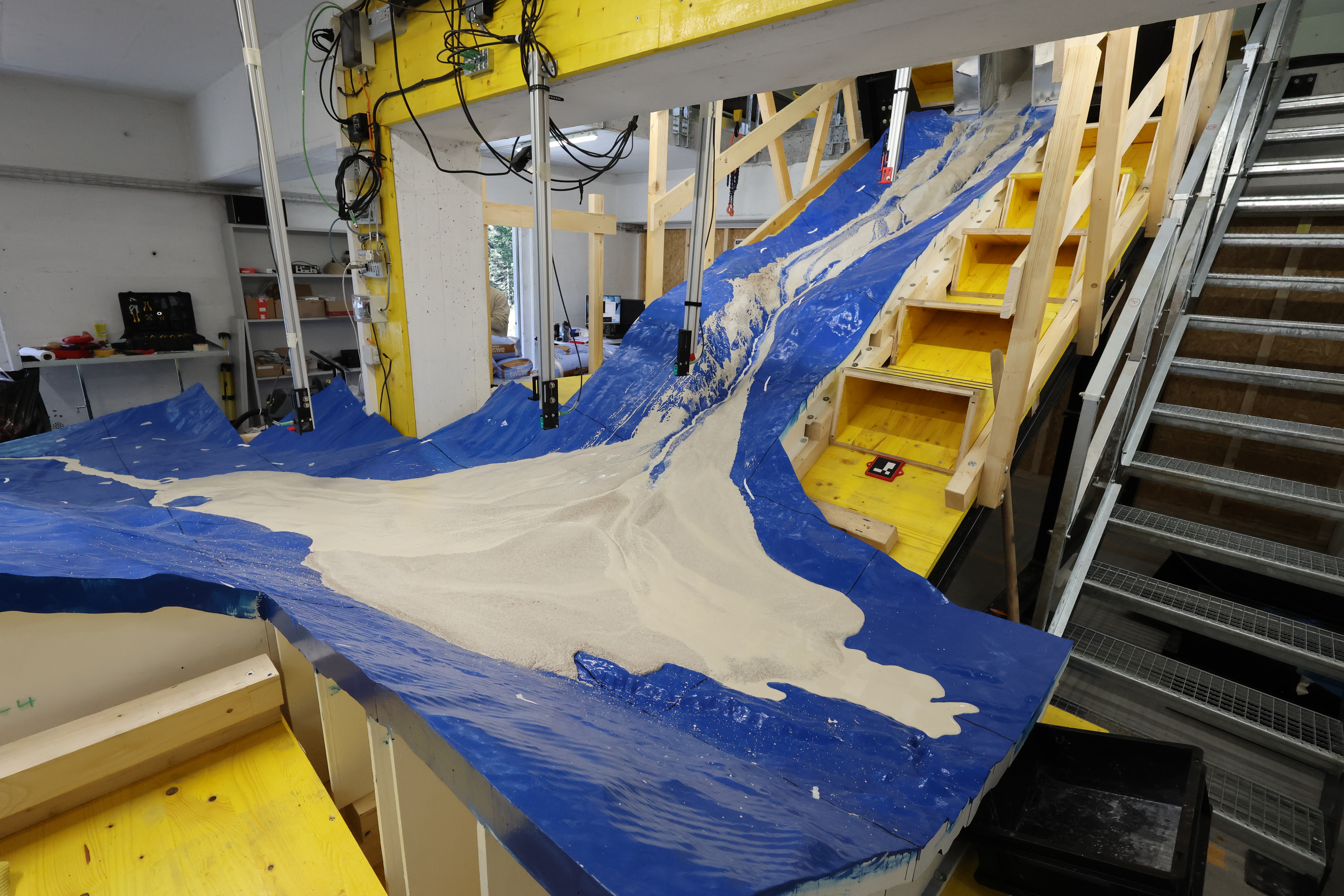
The Blatten model is just the first of this size (see box). The researchers used specially programmed software to select the landform, break it down into small sections and print the terrain segments (each of which measures approximately 50 x 50 cm) piece by piece. They then assembled, coated and painted the model in a former military bunker near Davos that now belongs to the SLF. "This is a vital step to achieve the desired roughness and optical properties," clarifies Hervé Vicari, a research assistant at the SLF, who came up with the idea of printing a model of Blatten. Numerous cameras, lasers and sensors, as well as a 3D scanner, measure parameters such as depth of runoff, speed, runout distance, deposition and impact dynamics of the artificial mass movement. The researchers precisely calculate the composition and the required proportions of the individual components, then blend the mixture in a bucket. They tip the mixture into a box at the top of the model before opening a hatch, triggering the event.
The model in numbers
- Dimensions of the flow channel:
- Inclined section: 4.5 x 2 m
- Horizontal runout: up to 6 m long
- Dimensions of the printed topographic model: 5.4 x 4.5 m (max.)
- Surface area of the model: approx. 12 m²
- Number of printed parts: 56
- Printing time: approx. 100 days
- Maximum input mass: 1 t
- Current input volume: 48 l
- Key measurement systems: cameras, lasers, 3D scanner, force plate, pore pressure sensors
Numerous projects planned 
In the future, researchers will also be able to mount other areas and landforms onto the substructure. "This is a long-term investment in research, not a short-term experiment," explains Gaume. Numerous projects are set to be conducted here to investigate various effects, from erosion and impact against obstacles to the distance the masses travel up counter slopes. Gaume is currently focused on one process in particular: "At the moment, we’re especially interested in the influence of terrain curvature on flow dynamics."
Links 
Contact 
Funding 
The research centre CERC is funded by the Canton of Grisons and the Swiss Federal Research Institute WSL and strengthened with two joint ETH Zurich professorships.
Copyright 
WSL and SLF are making image and audio material available free of charge for use in press coverage related to this press release. The inclusion of this material in image, audio, and/or video databases, as well as its sale by third parties, is not permitted.