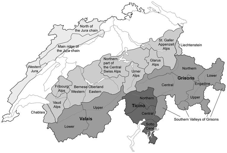
For the purposes of the avalanche bulletin, the Swiss Alps are divided in alignment with the warning regions used by the other federal natural hazard agencies (MeteoSwiss, Federal Office for the Environment (FOEN), Swiss Seismological Service (SED)). Groups consisting of several warning regions are formed, generally by applying climatological or political criteria, yielding overarching region names (see the maps below).
Great care is required when interpreting references in the context of backcountry tours in regional border areas. For example, the Jungfrau region is usually accessed from the north (northern flank of the Alps or Bernese Oberland), but the backcountry touring area mostly lies in Valais.

Marginal areas
There are no clearly defined boundaries between two regions with different danger assessments (e.g. different danger levels or different frequencies of avalanche prone locations) but instead transitional areas which in many cases cannot be clearly assigned to either avalanche situation. This means that in a marginal area several kilometres wide, it can be assumed that either the more or the less favourite situation may apply.
Those undertaking backcountry ski or snowshoe hiking tours in such areas should therefore consult the avalanche bulletin for both regions in question.
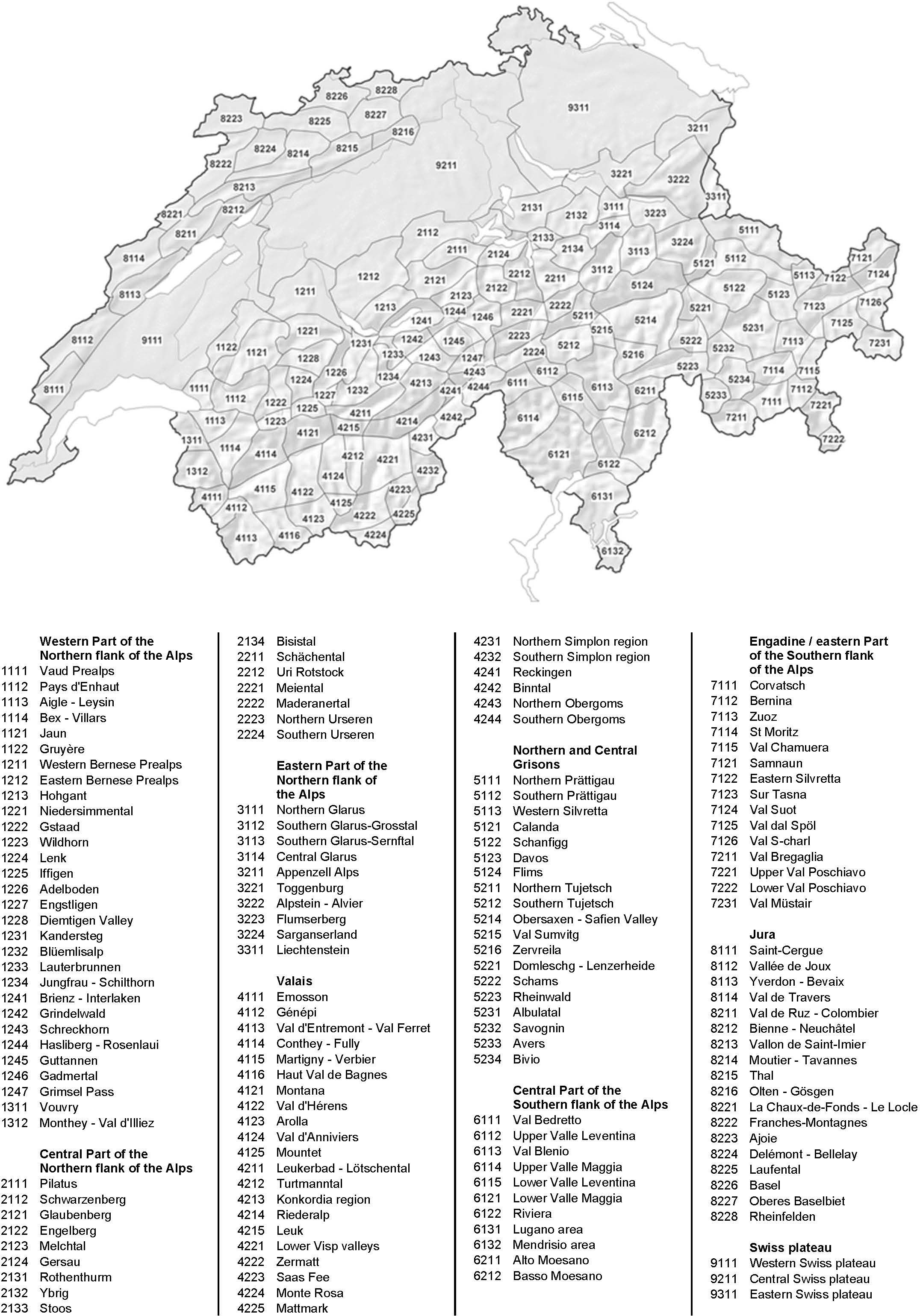
Warning regions (the 149 smallest units) 
Regional borders are meant to be seen as transitional zones. For that reason, the actual lines are generalized.
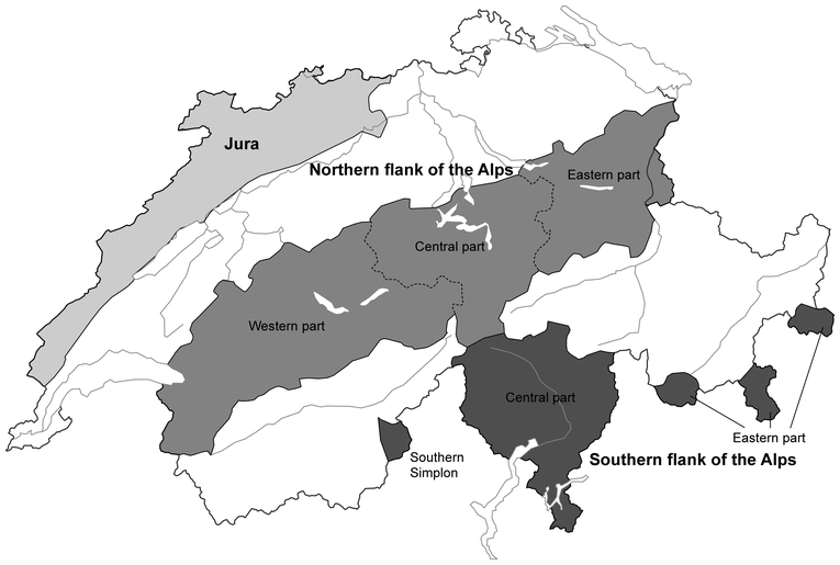
Northern and southern flanks of the Alps, and the Jura 
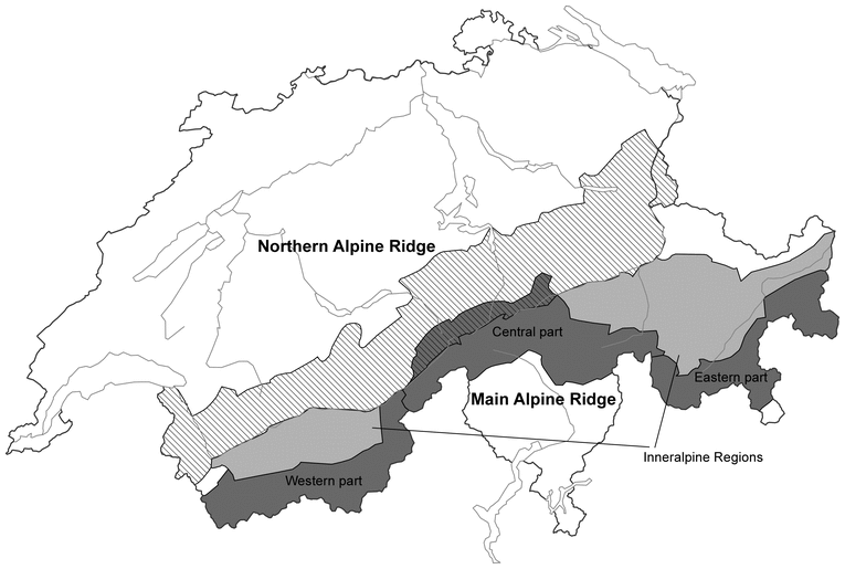
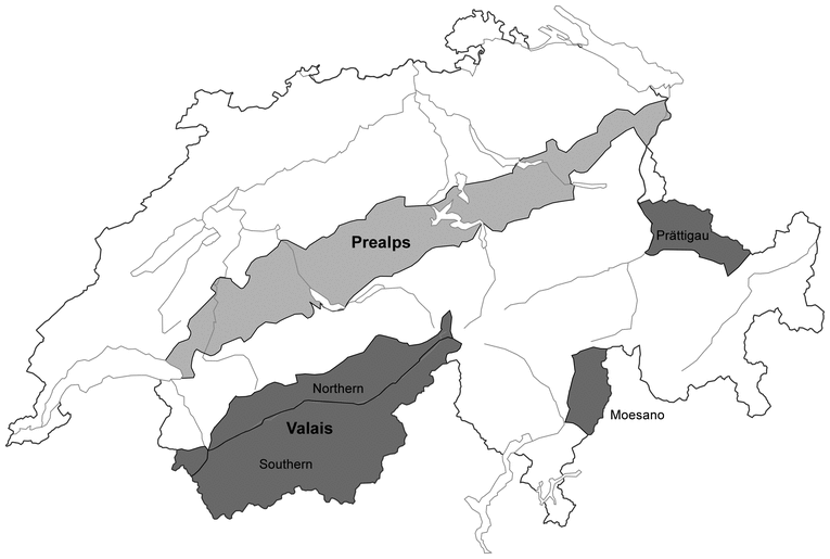
Main Alpine Ridge, Northern Alpine Ridge and Inneralpine Regions 
The Main Alpine Ridge extends from Val Ferret via the Great St Bernard, Monte Rosa, Simplon, Gotthard, Lukmanier, San Bernardino, Maloja and Bernina passes to beyond Val Müstair.
The Northern Alpine Ridge covers a belt running from the Dent du Midi via the Wildstrubel and Jungfrau regions and Gotthard, Tödi and Vorab to Liechtenstein.
The Inneralpine Regions encompass the regions between the Main Alpine Ridge and the Northern Alpine Ridge, namely those of Central Valais, and parts of Northern and Central Grisons and Engadine.
Major political regions 
The Grisons southern valleys consist of Val Mesolcina and Val Calanca (collectively Moesano), Val Bregaglia, Val Poschiavo and Val Müstair.
Political subregions 1 
Political subregions 2 
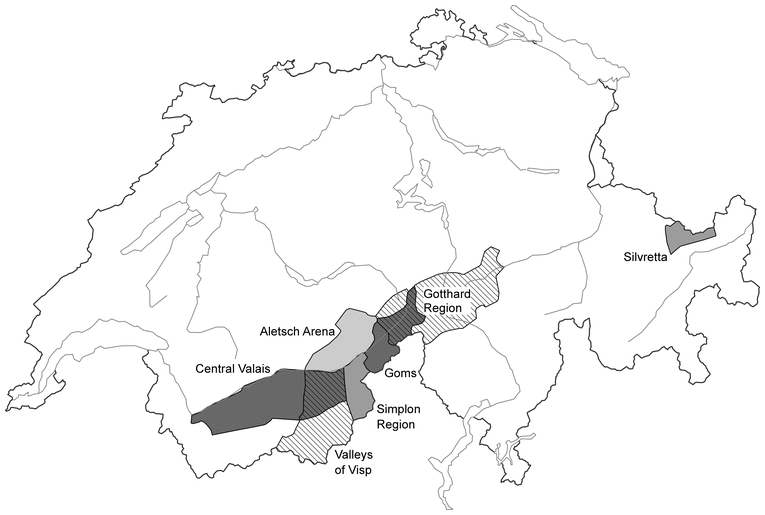
The Gotthard region consists of Obergoms, the Grimsel region, Urseren, Tavetsch, the Upper Valle Leventina and Val Bedretto.