Every avalanche observed in Davos since the winter of 1949/50 has been recorded and mapped. The data spanning all those years constitute a very valuable resource for avalanche researchers, and one that is unique anywhere in the world.
Who benefits from this mapping?
Avalanche activity is a very important factor for both avalanche forecasters and avalanche researchers. For instance, it can be used to check the forecast avalanche danger from the avalanche bulletin (particularly for high danger levels). Fundamental questions regarding the number and distribution of avalanches and avalanche prone locations can also be investigated. These, for example, enable avalanche danger scale definitions to be produced or updated, or forecasting tools to be developed. Observations of released avalanches are also key to investigating avalanche formation, as they provide information about the number and type of avalanches that have occurred on specific slopes under given snowpack or weather conditions. Ultimately, such extensive observations covering many years are also key to developing models of the avalanche dynamics.
How are avalanches in Davos recorded?
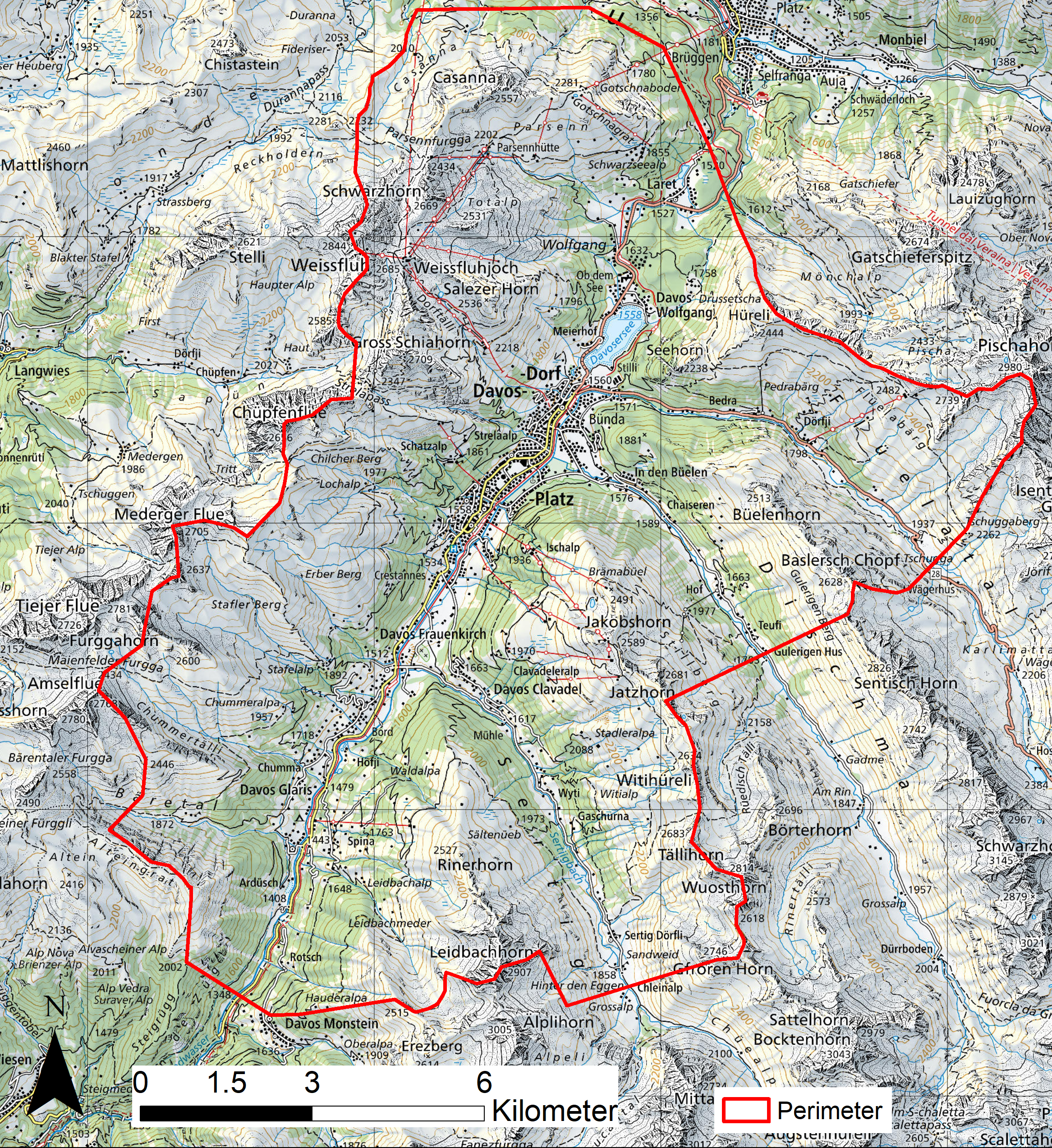
The outlines of observed avalanches are recorded in close cooperation between the SLF and the rescue services of the mountain railways/cableways as well as the commune's avalanche warning service. The aim is to make the avalanche mapping as comprehensive as possible. The avalanche recording area covers around 160 km2 (see Fig. 1). This includes freeriding and ski touring areas as well as areas with transport routes (roads, railways/cableways and cross-country ski tracks) and buildings.
What is recorded?
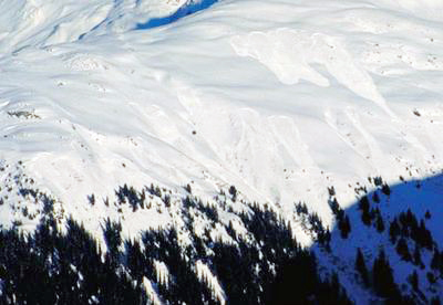
Insofar as possible, all slab avalanches with a minimum size of 50 m in one direction, and loose-snow avalanches of at least size 3 (large), are recorded. Impaired visibility during snowfall and windy conditions restricts observation and mapping activities. In addition, avalanches can be covered and concealed by fresh snow before they are observed – a source of error that simply has to be accepted. Particularly in case of high avalanche activity, avalanches must be documented quickly and easily (see Fig. 2). Therefore, they are recorded by means of photographs in the field, which are then mapped on returning to the office. This straightforward method has proven highly effective.