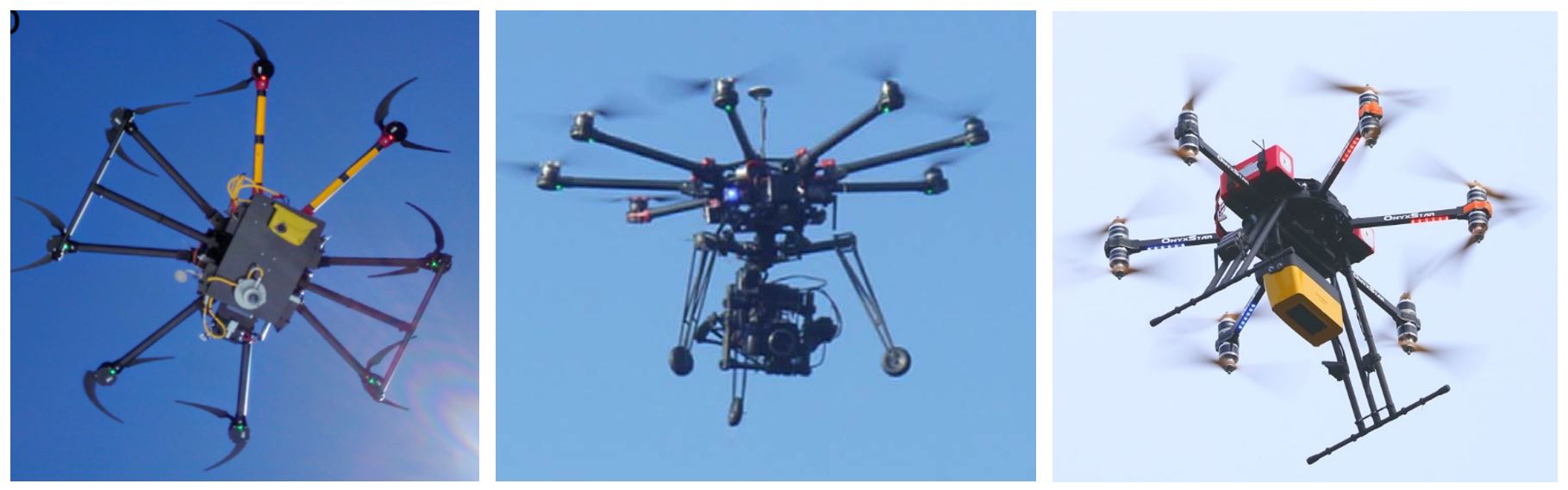
Aerial observations allow us to see trees and snow from new perspectives above the forest and over larger areas than with instruments on a tower.
We use drones to understand how forests, snow and radiation affect the properties of the land surface at large scales. In particular, drones equipped with radiation sensors, cameras or laser scanners allow us to measure solar and thermal radiation patterns of the forest, the forest structure, and varied snow cover patterns. Our drones allow us to see these patterns over large areas than towers, more frequently and with more spatial detail than manned aircraft or satellites.
Land surface reflectivity in forests
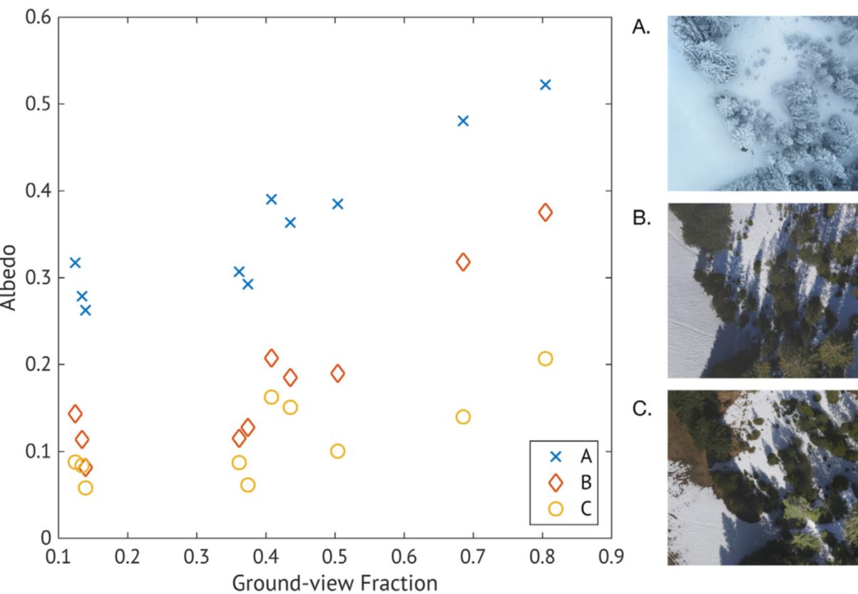
Bright white snow can reflect up to 99% of solar radiation, but the presence of forests above the snowpack mean most solar radiation is absorbed and reflected by the forest before it can reach the snow surface. The amount of solar radiation absorbed and reflected by a forest snow land surface is controlled by the forest density and the amount of snow both on the ground and in the trees. We equip a drone with up- and down-looking radiation sensors to enable us to measure forest snow land surface reflectivity (known as albedo) at many locations with different forest densities and tree arrangement. Our measurements show that snow in trees increase the land surface reflectivity up to 30% (figure of photos). In contrast, shadowing of the snow surface by trees has the opposite effect on land surface reflectivity through preventing most solar radiation reaching the snow surface. This effect is strongest when the sun is low in the sky, and the shadows appear to darken much of the snow surface, reducing the amount of radiation reflected by up to 30%.
Forest temperatures
Forests warm up when exposed to solar radiation and then emit thermal energy to the snow surface. Combining drone- and ground based thermal images, we were able to create 3D models showing both horizontal and vertical variations in forest temperatures. In denser forests, the tops of trees heat up on the side exposed to solar radiation, while the lower and shadier areas of the forest stay relatively cooler. During the day, these vertical differences remain the same, even though the forest overall warms up in response to air temperature and solar radiation increases.
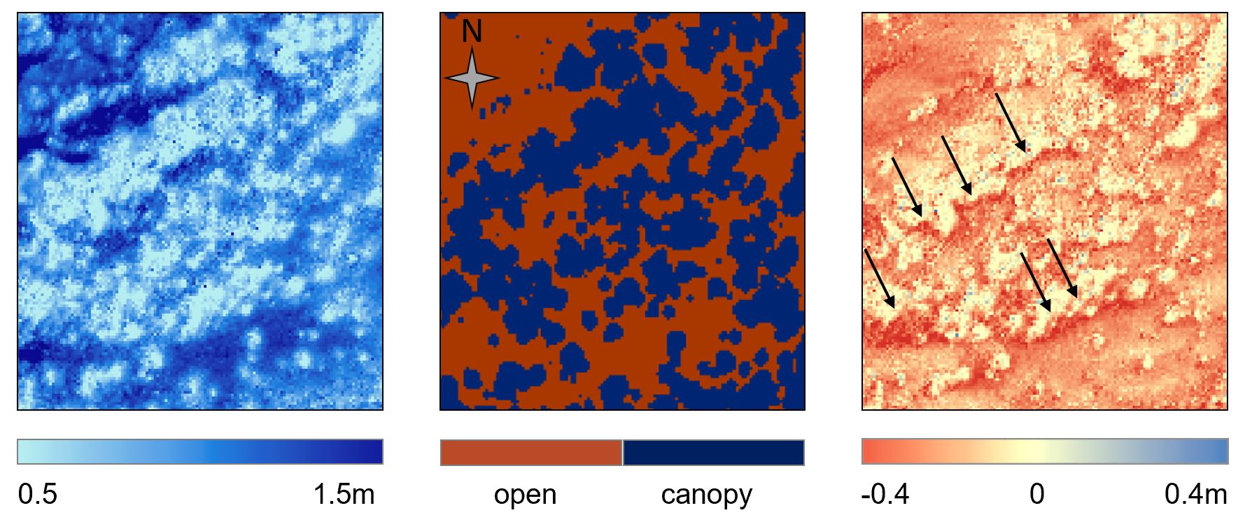
Snow distribution
Laser scanning, or LiDAR, technology can ‘see’ below the forest better than aerial imagery, giving us information on both the forest structure and the snow cover below it. Using airborne laser scanning (ALS), we obtain detailed maps of the snow distribution in forests and link these patterns to the forest structure. Drone-based laser scanning acquisitions are cheaper, more flexible, and allow us to capture snow distribution pattern at higher detail and frequency than measurements from manned aircraft. With repeated drone flights, we track snow distribution as it evolves throughout the winter in complex terrain over large and/or inaccessible areas. Our measurements show snow accumulation and melt in forests is strongly controlled by the location of individual trees, and these relationships are different between shaded north and sunny south slopes.