The SLF regularly receives enquiries about rockfalls, rockslides and debris flows. In this FAQ, you will find our experts' answers to the most frequently asked questions.
Rockfall, debris flow, rockslide, landslide – what's the difference?
- Debris flow: Mixture of water with solid material such as rock and wood. Debris flows can reach comparatively high speeds and travel for kilometres.
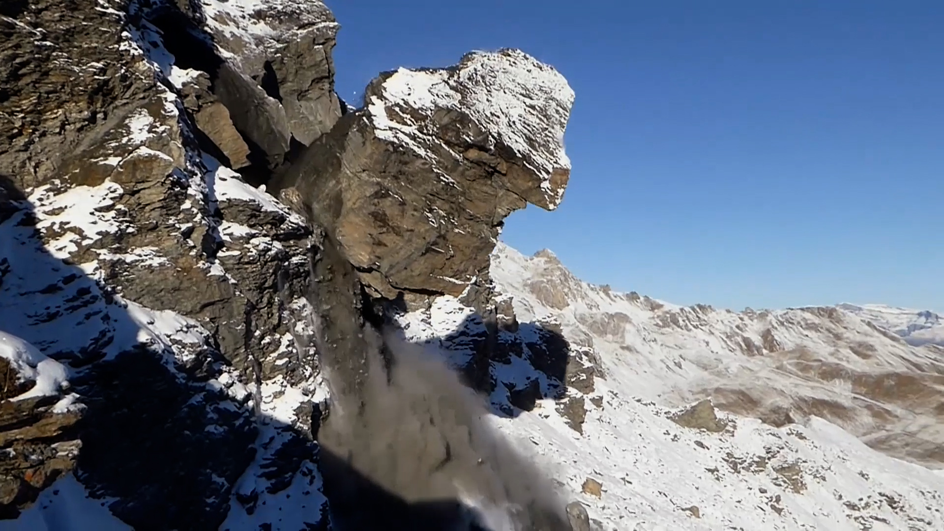
- Rockfall: Falling individual rocks with a diameter of less than 50 centimetres are referred to as rockfall.
- Blockfall: Larger rocks are called blocks or boulders.
- Landslide: When solid material such as rock and stone slides downwards on a solid base layer, it is called a landslide. This may be a centuries-long process, or it may happen quickly and spontaneously.
- Rockslide: Falling stones and rocks with a total volume of at least 100 cubic metres – equivalent, on average, to the capacity of 500 to 600 bathtubs – are known as a rockslide.
- Rock avalanche: A rockslide becomes a rock avalanche when the volume of rock exceeds one million cubic metres, equivalent to 1,000 to 2,000 single-family homes.
How dangerous are these phenomena?
Debris flows destroy buildings, power lines and anything else that lies in their path. The fact that they often feature a high proportion of large boulders, combined with their speed, makes them among the top three events in Switzerland in terms of the amount of damage caused. They are particularly dangerous for humans as they occur with very little warning, often taking just minutes to reach a critical point.
Landslides are different. They may happen spontaneously and quickly, or take place over hundreds of years. Some slopes move at the rate of a few millimetres or centimetres per year, rarely more, although spontaneous slides reach speeds of several metres per second. On their way downwards, the slopes carry everything with them. This can result, for example, in cracks forming in buildings and roads over a period of years. Spontaneous landslides can also pose a danger to life.
Essentially, for people outdoors, even a small stone can cause severe injuries if it is moving fast enough and lands in the wrong place. Buildings protect people from rockfalls. Rockslides and rock avalanches often have a destructive impact and cause considerable damage.

What triggers such events?
Debris flows are mainly triggered by heavy rain and melting snow. If the ground is saturated with water, this can also lead to a landslide. However, landslides can equally be triggered by other factors such as the weight of buildings or structures. Just one careless step by a single individual is enough to set off a rockfall. Animals such as chamois can also trigger a rockfall, when crossing a scree field, for example. Roots break up rocks, and trees act like levers in strong winds. Other factors are weathering, thunderstorms and earthquakes. Water that penetrates and freezes in crevices causes repeated fragmentation of rock. The same happens when the water pressure in the rock becomes too great. This can result in a rockslide or even a rock avalanche. The local geological conditions also play an important role, as they determine whether an event can occur.
In high alpine regions, thawing permafrost can also cause the rock to let through more water than previously. In the short term, this makes the rock more susceptible to slides and avalanches.
Why isn't there a rockslide warning service, similar to the avalanche warning service, or a rockfall/rockslide bulletin like the one for avalanches?
Natural avalanches are usually the direct result of meteorological events such as snowfall or solar radiation. As a general rule, therefore, the avalanche hazard is predictable and is often of a comparable magnitude within a given region. On neighbouring slopes with the same orientation and incline, the avalanche conditions are similar. This means that the avalanche warning service can publish daily status reports. By contrast, debris flows, rockslides and the like are local events. One slope or rock may be unstable but the neighbouring one stable, making it virtually impossible to specify a general status.
What protective measures are helpful?
Protective structures such as dams and galleries direct debris flows and rockfalls into predetermined paths, keeping them away from infrastructure. Safety nets also help against falling rocks and blocks, while officials are able to anchor some boulders securely to the ground. With landslides, draining the subsoil can slow down the process in some cases. In the case of rockslides and rock avalanches, the only option is usually to evacuate the affected areas.
How is it possible to detect imminent hazards at an early stage?
Satellites now provide large-scale radar images of the Swiss Alps. This allows experts to see whether slopes are moving and to pinpoint those that are. Even so, there are blind spots owing to the geometry of the mountains and the orbits of the satellites. An increased incidence of rockfall in a locality can also indicate greater slope instability, as can cracks in the ground, rocks and buildings. When it is clear that a slope is moving, it is important to examine and monitor it in detail (see below).
And what are the short-term warning signs?
Falling rocks and cracks in the ground, rocks and buildings are precursors of rockslides and rock avalanches. Usually, the greater the volume, the longer the warning time. However, the signals often go unnoticed, particularly in remote areas, so the event seems to come out of the blue.
Predicting the timing of debris flows is much more difficult. However, in most cases the channels in which they occur are known. In principle, debris flows are to be expected in these channels whenever there is heavy rainfall. In particular, if a lot of loose debris has accumulated in the channels or tree trunks are blocking the flow channel, there is a greater likelihood of a debris flow occurring the next time it rains.
Rockfalls are virtually impossible to predict, so protective measures are the only way to help reduce the risk.
How do experts monitor unstable slopes?
Various methods are used, such as RADAR or scanning the slope with a laser (known as LiDAR). Drones fitted with cameras and other sensors make it possible to monitor inaccessible and dangerous locations from the air. In certain places, permanently installed GPS devices can record movements or reflectors can be installed whose movement can then be determined from the valley below.
What should hikers look out for? How should they behave?
Normally, the risk of natural hazards on hiking trails in the Alps is low. Although there is always a residual risk, a hiker is statistically much more likely to fall or to sustain another self-inflicted injury than to be hit by a rock. Warning signs such as fresh impact marks, rock deposits and failure scars are also indicators of danger. Generally speaking, the higher the altitude and the more exposed the path, the greater the risk. Hikers are themselves responsible for taking that risk. If a path or route is exposed, they are advised not to stop there but to keep moving briskly.
The weather too plays a role. In heavy rain and when the snow is melting, hikers should avoid steep slopes and exposed paths, as there is an increased risk of rockfall in these places at such times.
On scree fields, it is also worth looking up. If there are animals such as chamois around, be extra vigilant as they may dislodge rocks and trigger a rockfall.
Will it still be possible to walk in the mountains in the future?
Yes, absolutely. On most hiking trails, the danger level will remain unchanged, being similar to what it was in the past.
How is climate change affecting these hazards?
The effects of climate change in high alpine regions are many and varied. Glaciers are shrinking, permafrost is thawing. Outside the permafrost regions, the changes are expected to be smaller. In high alpine regions with permafrost, rockslides and rock avalanches may occur more frequently in the future. SLF researchers have published an interactive overview of past rockslides and rock avalanches here. Rockfalls are also expected to become a more common occurrence in high alpine regions.
If heavy rainfall intensifies, debris flows could increase. However, this has not been conclusively proved as a debris flow always involves material as well. If the water no longer finds any material on its downward path, for example because debris flows have already washed through the channels, no new debris flow can occur.
Is there any difference between rockslides in the permafrost and below the permafrost?
No.
Are there hazard maps for permafrost?
Permafrost is not a natural hazard; ultimately, it is the temperature of the rock that matters, as this influences the stability of the rock. However, there are risk analyses that consider permafrost as one of many factors. Our reference maps show where permafrost may occur.
What can researchers simulate and predict using software such as RAMMS?
This software simulates the runout of debris flows and rockslides or rock avalanches. It shows how far such an event could extend and what area – and hence what infrastructure – would be affected.
Links 
Contact 
- E-Mail: medien(at)slf.ch
- Phone +41 81 417 01 90
Copyright 
WSL and SLF provide the artwork for imaging of press articles relating to this media release for free. Transferring and saving the images in image databases and saving of images by third parties is not allowed.