White Risk is the app for all those who engage in winter activities in the mountains outside marked and open pistes. By way of the avalanche bulletin and snow and weather data, it gives users up-to-date information about the snow and avalanche situation in Switzerland. The app also provides useful background knowledge to assist in assessing the avalanche danger. Various tools, such as the Analyser, help the user to evaluate the avalanche situation in the field. A key element of the app is its TOUR function, which allows tours to be planned or edited and enables users to synchronise the data belonging to planned tours with the web platform www.whiterisk.ch. A personal library of tours can thus be compiled and subsequently updated both with the app and on the platform. Purchasers of a standard licence can use premium topographical maps of Switzerland, France and Austria with various layers, including one for slope angles, for planning purposes. Maps of any area freely defined by the user can be downloaded for use offline.
The smartphone’s GPS function shows the user’s current location on the tour plan. The app gives free access to the snow and temperature data collected by the automated measuring stations operated by the cantons and the SLF. These additional data are also useful for tour planning purposes.

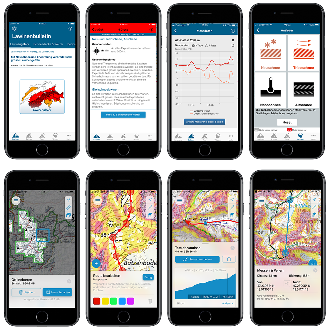
Image 1 of 1
Screenshots of the White Risk iOS app
Top row:
Screens 1 and 2: Current avalanche bulletin
Screen 3: Example of current measured values (last 3 days) recorded by an automated measuring station
Screen 4: Analyser for assessing avalanche problems
Bottom row:
Screen 1: Download page for offline maps
Screen 2: Route editing based on a Swisstopo map with slope angles
Screen 3: Route and altitude profile with timings based on an IGN map of France
Screen 4: Direction finding and measuring based on a BEV map of Austria
Costs
The app can be downloaded free of charge and in four languages from iTunes Appstore and Google Play Store.