Alpine3D is a spatial, three-dimensional snow cover and earth surface model developed by the SLF. It simulates the most important physical processes (mass and energy exchange) that take place between the atmosphere, snow and soil on mountain topography. It consists of a number of modules that can be activated as required:
- Snow transport ("SnowDrift")
- Radiation ("EBalance")
- Runoff ("runoff")
Applications
Alpine3D has a whole range of possible applications. Its primary use is for assessing water resources in mountain catchments (Michlmayr et al., 2008), including the forecasting of future snow conditions. This involves performing simulations based on climate change scenarios (Bavay et al., 2009, 2012). Another application is predicting snow conditions on ski runs, as, for example, at the Winter Olympics in Vancouver (2010), Sochi (2014) and South Korea (2018) in collaboration with Swiss Olympic.
Who is Alpine3D for?
Researchers and developers in the following areas: snow, avalanches, permafrost, glaciology, ecology, hydrology, climate and snow sports (e.g. snow farming, ski slope meteorology), among others.
Technical requirements and general conditions
The model is available as an integrated software package. It is open-source software licensed under the LGPL version 3 or later (see www.gnu.org). To ease integration with other models, Alpine3D is structured as a library (libAlpine3D) and as an application that performs simulations based on the library (Alpine3D). There are new software releases once or twice a year. You can get more information at alpine3d.slf.ch.
Costs/Terms of use
Costs: Alpine3D is free to download and use.
Terms of use: The following LGPL licence terms must be observed.
Documentation for the latest release
Downloads and more information
See alpine3d.slf.ch. To download the software, please send an email with the required information to bavay@slf.ch.
Detail-Description
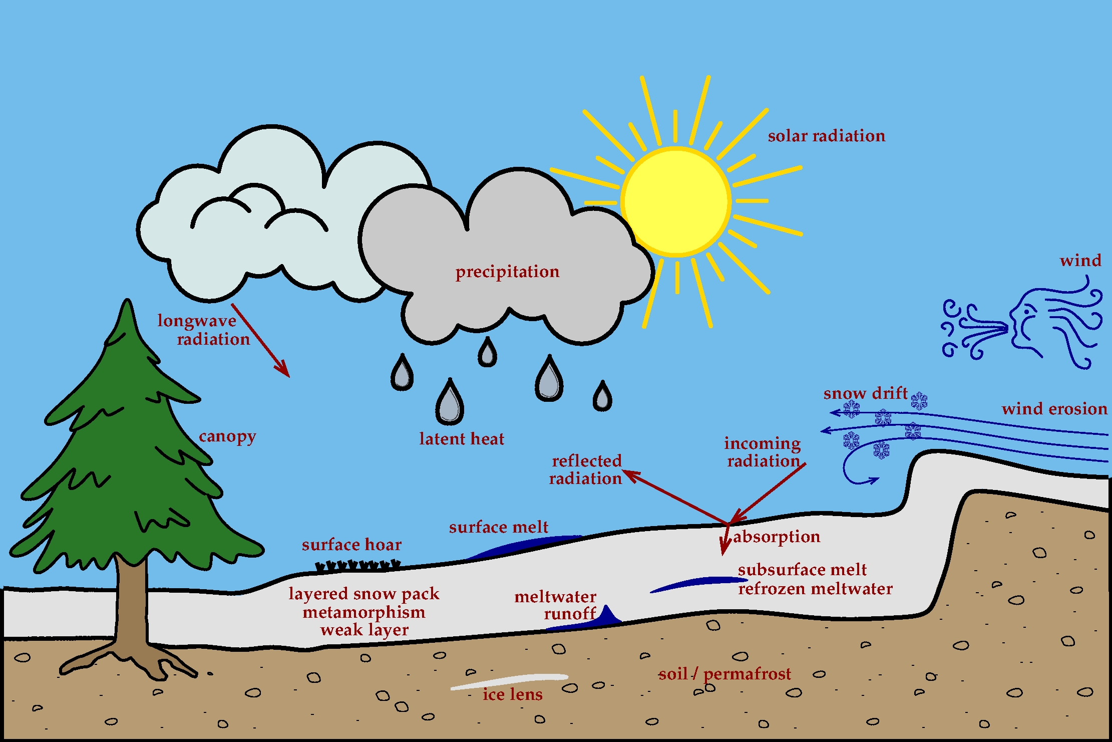
At the core of the Alpine3D-model, is the SNOWPACK model, a physically based, energy balance model for a 1D soil/snow/canopy column. This provides a very detailed description of the snow stratigraphy and a very good evaluation of the mass and energy balance. In Alpine3D this 1D energy balance is performed for each pixel of the domain (therefore it is a distributed SNOWPACK simulation) and for one time step (usually one hour). Any quantity that the user would like to get out of the simulation can be written out from this module.
In order to perform a SNOWPACK simulation at every pixel of the domain, it is necessary to get the meteorological input data (meteorological forcing) for each pixel. But the measured meteorological parameters are usually measured by a set of stations, which means that the data is available at a set of points. Interpolating these points measurements to every pixels of the domain is performed by the means of statistical interpolations with the MeteoIO library, that was also developed by SLF. If the forcing data is coming out of another model (such as a meteorological model), most probably the input grids have a resolution that is very insufficient for Alpine3D and therefore need downscaling. If the downscaling factor is very large, we often end up with only a few points from the meteorological model that are part of the Alpine3D domain, therefore such points can be considered as "virtual stations" and spatially interpolated similarly to weather stations.

The core principles laid out in the previous section rely on the assumption that there are no lateral fluxes, which might be for some aspects too strong of an assumption. Therefore the lateral fluxes deemed relevant are introduced by other modules:
- the EBalance module computes the radiation fields, taking into account atmospheric cloudiness, topographic shading effects and reflections by the surrounding terrain.
- the SnowDrift module that simulates the transport of snow by the wind. It performs a 3D simulation of the saltation, suspension and diffusion processes.
- the runoff module that collects the precipitation and/or melt water at each pixel to transfer it to an hydrological routing module
Contact
Mathias Bavay
Publications
- Lehning et al. 2006: ALPINE3D: A detailed model of mountain surface processes and its application to snow hydrology.
- Kuonen, P. et al.2010: POP-C++ and Alpine3D: petition for a new HPC approach.
- Bavay et al.2008: Simulations of future snow cover and discharge in Alpine headwater catchments.
- Raderschall et al.2008: Fine scale modelling of the boundary layer wind field over steep topography.