Rockfall research at the SLF – experiments supply inputs for computer models
Marc Christen
Perry Bartelt
Yves Bühler
2016 - 2021
Contents 

The SLF can look back on a long and successful history of participation in snow and avalanche research. Among its accomplishments is the simulation software RAMMS, which it has developed specifically for practitioners. In recent years, RAMMS modules for debris flows, landslides and rockfalls have been added to the proven avalanche module. Data from case studies and, to a growing extent, field studies, are facilitating the testing and validation of the RAMMS::ROCKFALL module. The principal objective is to record, by way of experiments, the entire trajectory of a rock as it descends the slope, including information of rotational velocities, impact forces, jump heights and distances etc. Before the experiments are conducted, rocks of a suitable shape and size are selected and equipped with sensors. The sensors that are currently available are capable of measuring acceleration of up to 400g (g = gravitational acceleration) – stunt pilots are exposed to forces of around 10g – and rotational speeds of up to 11 revolutions a second. Conventional video recordings show the trajectory through the local terrain. Then, in conjunction with the temporal data captured by the sensors, the jump heights and distances can thereby be estimated.
Experiments at Flüela Pass (GR) 
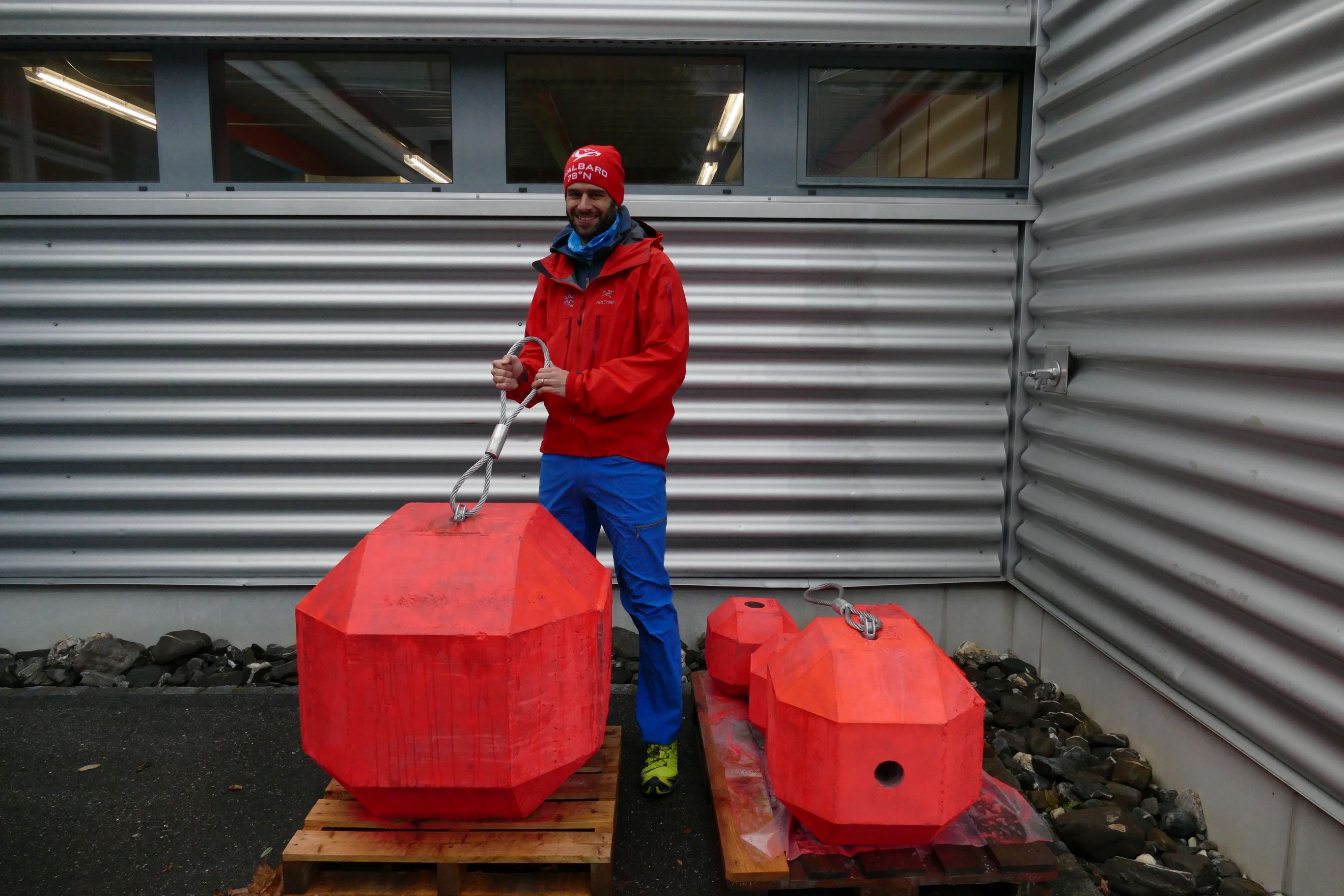
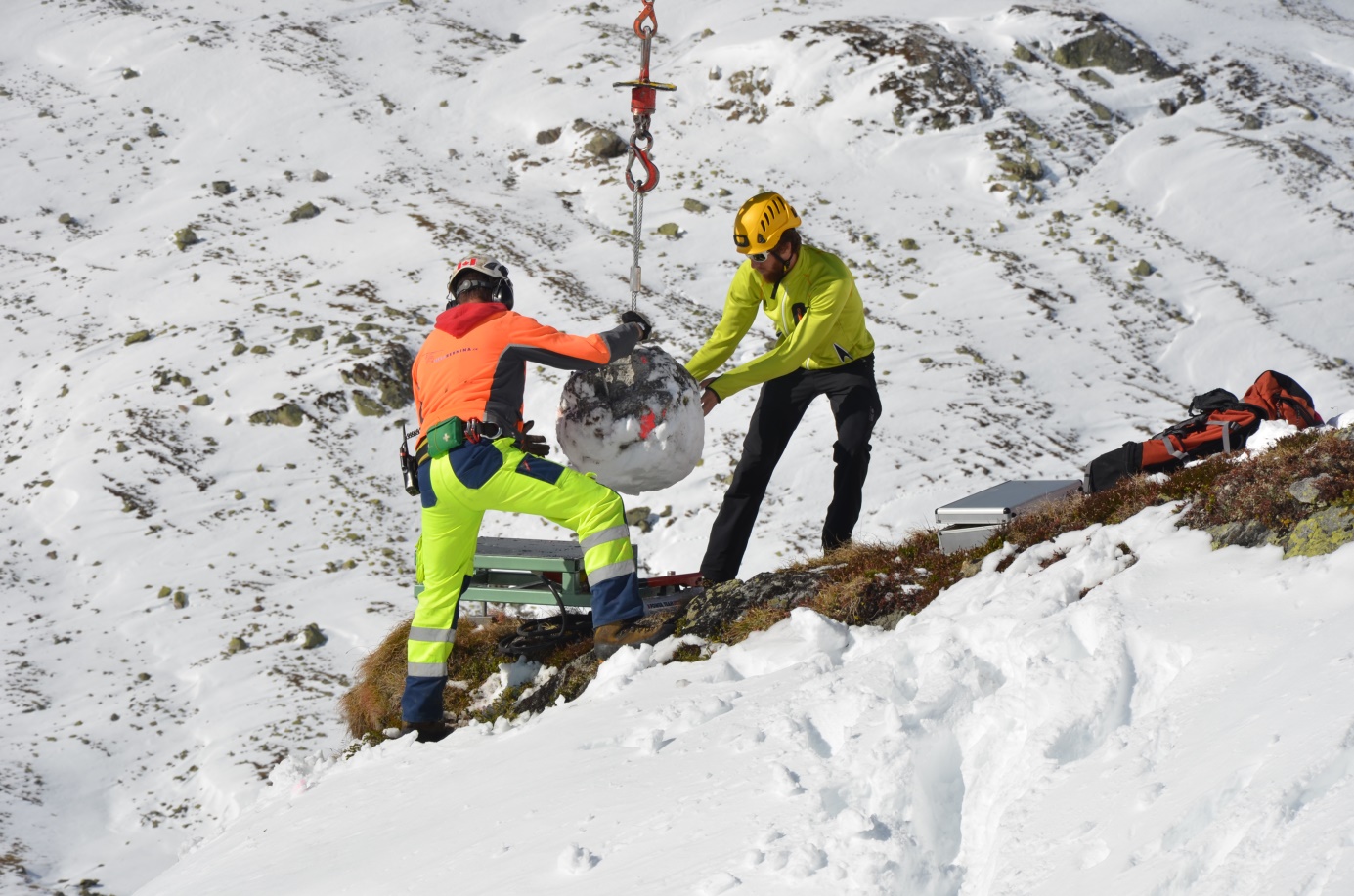
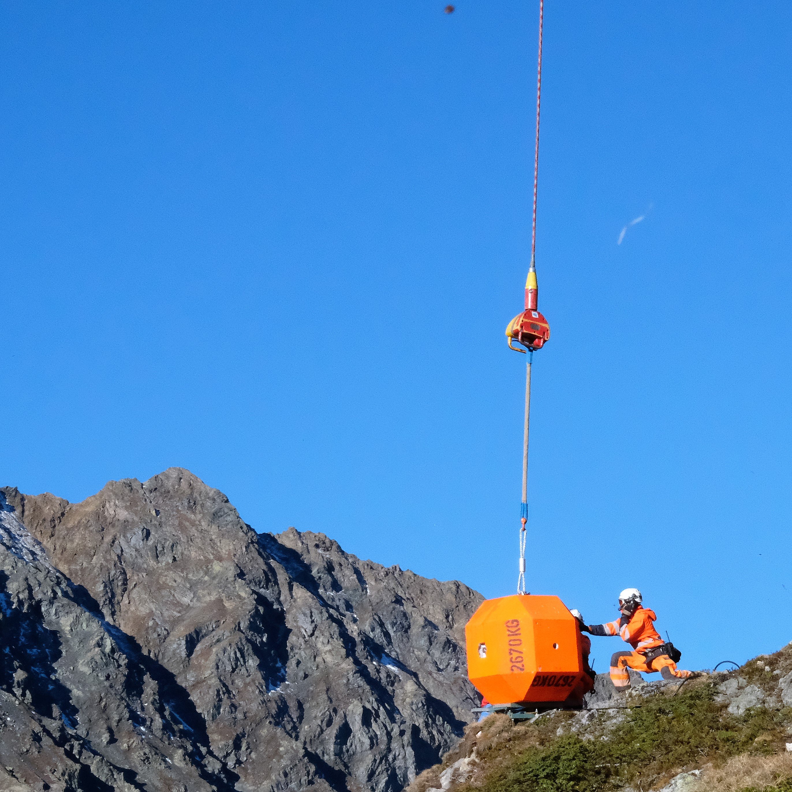
As in the last two years, SLF researchers are conducting rockfall experiments at Chant Sura on the Flüela Pass in the summer of 2019. They are using artificial rocks made of concrete rather than natural stones. In an initial series of experiments, all the rocks have the same dice-like shape but different weights. The lightest weighs 44 kg, the heaviest around 2670 kg. The advantage of using artificial rocks is that they are very easy to compare, and large numbers of identical rocks can be produced. This makes it possible to investigate the effect of weight on movement behaviour, without differences in shape affecting the result. Determining the effect of shape will be a focus of future experiments, which will include tests using wheel-shaped rocks.
The test site is a slope of approximately 40 degrees and 300 m in length. While the researchers set a rock rolling down the slope, sensors mounted in the rock measure its rotations and accelerations in all three axes. The runout distances are measured using a highly accurate GPS device. The researchers are also using synchronised high-resolution videogrammetry for the first time, a technique in which two to three cameras each record 25 images per second from different viewing angles at a resolution of 8K. This enables conclusions to be drawn about jump distances, and in an ideal scenario the researchers can reconstruct the entire trajectory of the rock in 3D from the stereo images recorded.
The data obtained will be used as a basis for testing upgrades to the RAMMS::ROCKFALL simulation software. Systematic test series, such as those carried out by the researchers at the Flüela Pass, provide a more accurate and comprehensive data source than case studies.


Experiments on Spitsbergen 
This September, for the second time, members of the RAMMS team take the opportunity provided by a workshop for students at the University Centre in Svalbard (UNIS) to host a day of rockfall experiments on Spitsbergen, the largest island of the Svalbard archipelago. The SLF researchers conduct the experiments with the students before presenting the lecture and accompanying exercises. The team digitises the rocks, inserts the relevant sensors, and records the trajectories of the rocks as they fly through the air and ultimately come to rest. Together with researchers attached to UNIS, they also produce a terrain model with the aid of a terrestrial laser scanner. During the subsequent classroom exercises the captured data is used to create an exact simulation of the field conditions and thus to compare the model's performance with the actual events.

Results of earlier experiments indicate that wheel-like movements play an even more significant role in rockfall movements than was previously assumed. These and other findings are continuously being applied to design further experiments and develop the sensor and data recording technology. Since RAMMS::ROCKFALL simulations can already be compared with actual experiments, the developers are able to mirror reality even more precisely. The ultimate aim is to provide practitioners with a valuable and calibrated tool to support their danger analysis and mapping work.