06.11.2019 | Logbook
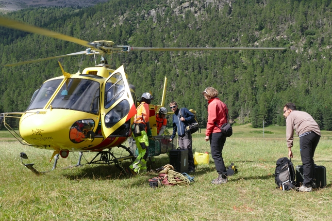
The geophysicist Jacopo Boaga from the University of Padova spent two months at the SLF. His aim was to test a new method to measure thawing permafrost. The challenge: getting around 150 kg of equipment up to high mountain test sites.
During Summer 2019, I carried out several geophysical tests together with the SLF Permafrost Group. Our aim was to explore permafrost, permanently frozen ground. It is found for example in so-called rock glaciers high up in the Alps. We were particularly interested in measuring the thickness of the upper layer above the permafrost that thaws seasonally. Due to global warming, the thickness of this so-called active layer can increase, which can destabilize steep slopes, leading to rock fall or landslides.
We focused on Electrical Resistivity Tomography (ERT) and electromagnetic (EM) methods, technologies able to provide information about the subsoil, measured directly at the surface.
Good planning is essential
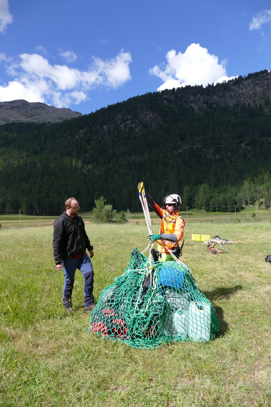
The geophysical techniques are very promising, since we can get a characterization of the frozen and unfrozen layers in a quick and non-invasive way, with no need to drill boreholes or dig trenches, which is a very complex task in a rock glacier. Nevertheless, we had to face a number of challenging issues working with geophysical instrumentation up there. Equipment is heavy: electrodes, cables, instrumentations, long probe, batteries, GPS, laptop, etc. No way to carry everything by ourselves! We needed a helicopter that can transport all our equipment in a net and bring SLF scientists directly to the study site at Schafberg near Pontresina in Grisons, at an altitude of 2,750 metres. This is quick and useful, but on the other hand, once you are there you are on your own and you have to plan carefully to have everything you need for the entire workday.
Hammering electrodes into the ground
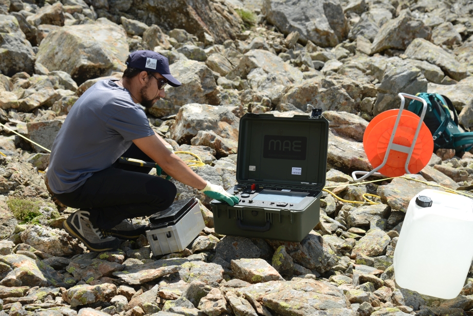
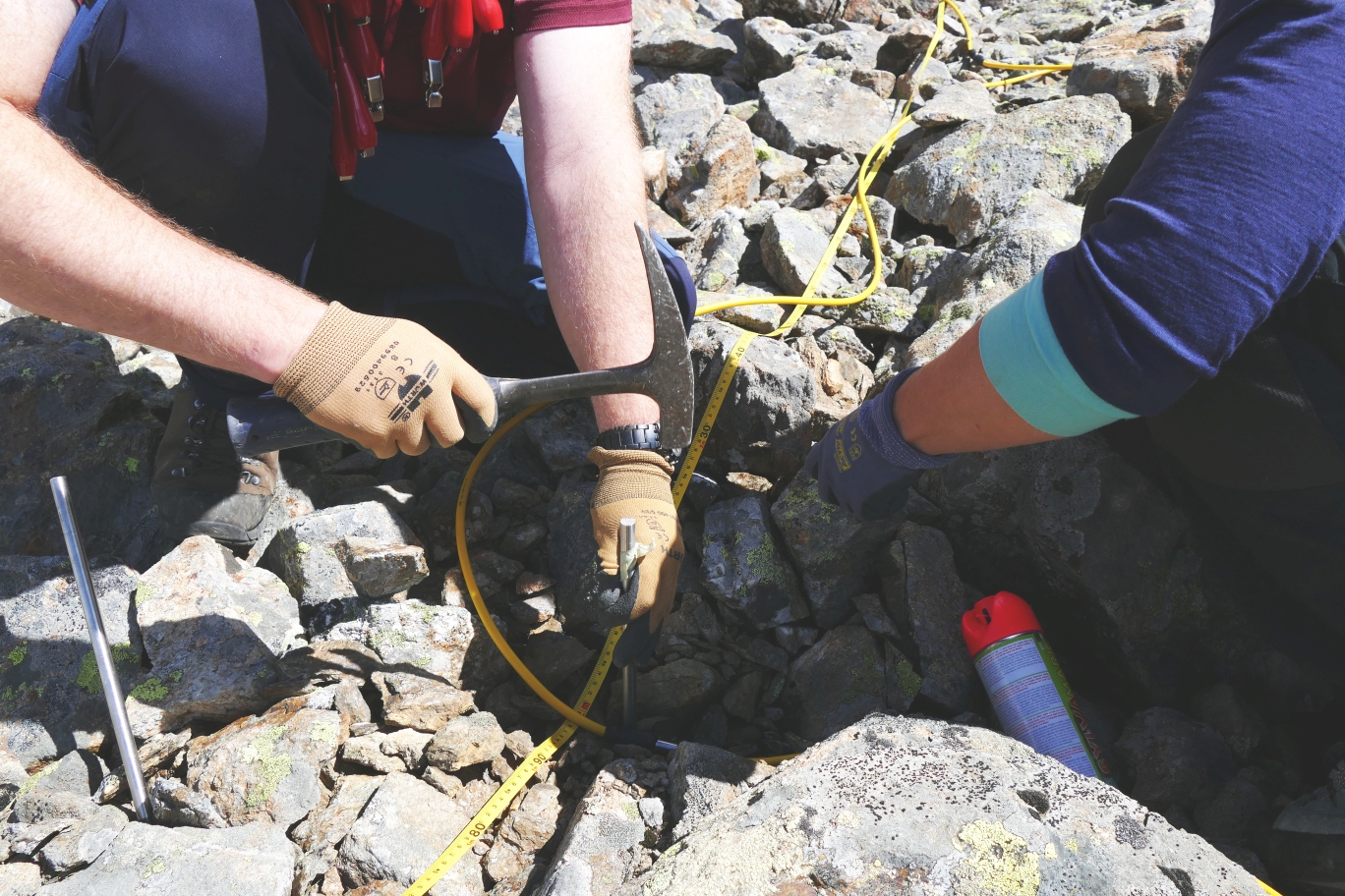
For the electrical measurements, for example, we need to hammer dozen of stainless steel electrodes into the blocky rock glacier surface, in order to establish electrical contact with the ground. This can take time because we have to remove the big blocks, hammer the electrodes and connect all the cables. In a rock glacier, due to the very high resistivity of ice, we have to wet each electrode to help the electrical contact. To do this, we use tanks of salt water (up to 50 liters) that must be prepared before and brought up there by the helicopter (most of the time there is no water in that high altitude environment). When the cables are connected to the electrodes the electrical measurements can last few hours, and will give us an image of the subsoil, locating the presence of ice, its thickness and characteristics. In those conditions we can only hope that everything is running well, as on the mountain we have no access to spare parts or external help. Data are then stored in external memories and, due to the effort spent to collect them, treated as a real treasure!

Image 1 of 8
Researchers use the electro-magnetometer to measure the conductivity of the substrate without contact. Image: C. Hoffmann, SLF

Image 2 of 8
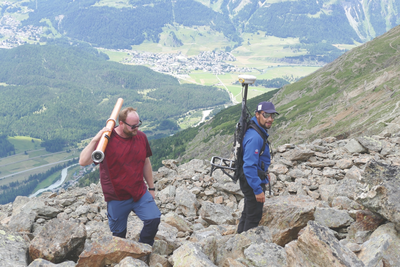
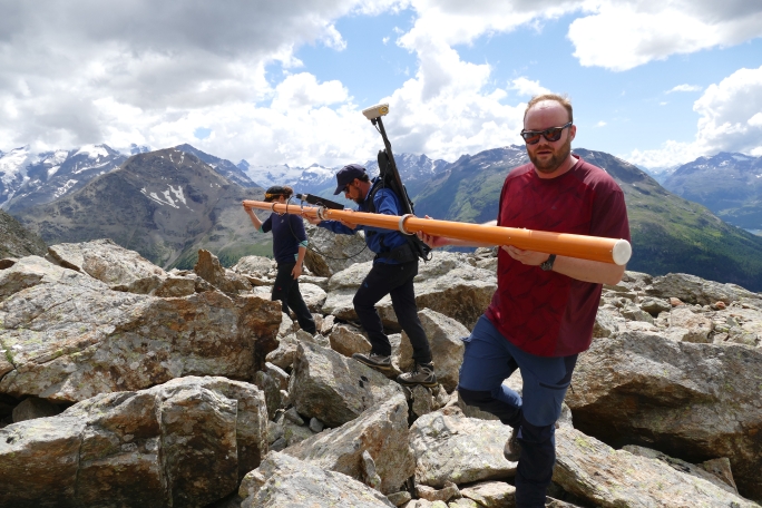
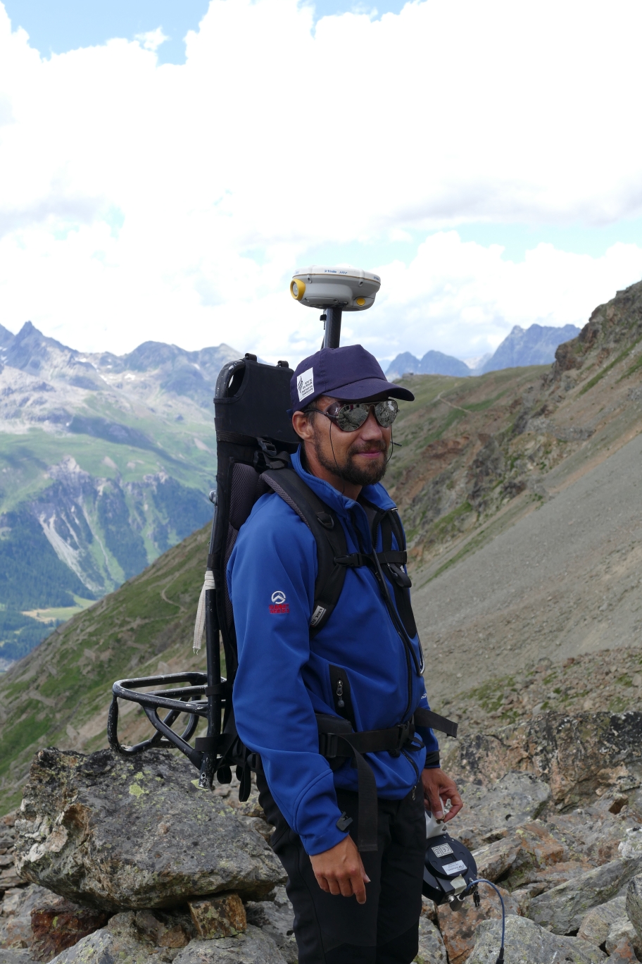
During the measurements, Jacopo carries a GPS device on his back that links the measured values to the respective position. Image: C. Hoffmann, SLF

Image 3 of 8
Jacopo Boaga measures the conductivity of the subsurface using Electrical Resistivity Tomography (ERT). Image: M. Phillips, SLF

Image 4 of 8
For this purpose, electrodes are hammered into the stony substrate with a hammer. Photo: C. Hoffmann, SLF

Image 5 of 8
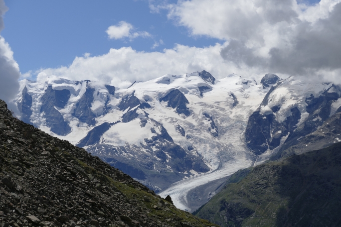
Reward for the strenuous work: wonderful view of the Morteratsch Glacier. Image: C. Hoffmann, SLF

Image 6 of 8
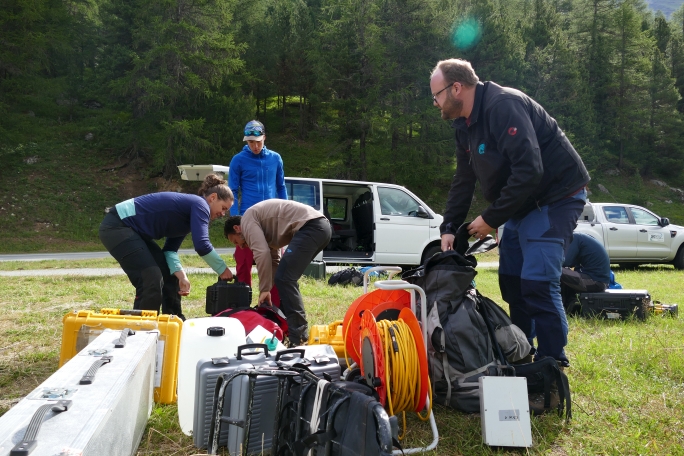
The total weight of the equipment is about 150 kilograms. Image: C. Hoffmann, SLF
Image 7 of 8
The material is packed into a net for helicopter transport. Image: C. Hoffmann, SLF

Image 8 of 8
Without a helicopter it would not be possible to transport everything to the mountains. Image: C. Hoffmann, SLF
Constant risk of stumbling
The Electro-magnetic measurements are easier from a logistic point of view, as we use a probe that does not need electrical contact with the ground. On the other hand, this means walking over the wobbly blocks of the rock glacier with a 6 m long probe antenna. Not easy at all! The rock glacier surface is very uneven, ranging from fine materials as clay to the huge boulders, forming a challenging surface to walk on. Three people are required to carry the antenna, and we must try to keep it horizontal and at a steady height from the ground to not influence the measurements. So we are at a constant risk of falling. The electromagnetic probe is connected to a GPS that the operator carries on his back, that will link the measurements collected to the correct position. However, up on the mountain we often have problems with satellite connections, and this implies we often have to interrupt the measurements and accept some data gaps.
Ibex and marmots
Working on a rock glacier also gives us the opportunity to enjoy beautiful landscapes that compensate for all the fieldwork efforts. We can enjoy the special views of the untouched mountain environments, sharing them with the local inhabitants such as ibex, marmots or hawks, who do not seem annoyed by the geophysicists’ work.