Detection and monitoring of mass movements in alpine areas
2021 - 2030
CooperationMass movements of different size and typology are more and more observed and expected to increase in alpine regions (link). In some cases, the rapid and potentially catastrophic evolution towards slope failure can directly affect anthropic infrastructures, economic activities, and in general human lives. In geologically young mountain ranges, such as the European Alps and the Himalayas, we have the possibility to directly observe and study the evolution of these geomorphological processes.
In the past, observation and mapping in the field has been the standard procedure to identify mass movements, often complemented by using stereoscopic terrestrial and/or aerial photointerpretation. In many cases, however, with this approach only weak indicators are visible and quantifiable. Moreover, despite recognition of such geomorphological features, very little or no information on the current activity was available. Remote sensing revolutionized the way how we detect, map, and monitor mass movements in alpine regions. Technological advances and data availability have exponentially increased; however, new approaches and best practices are needed to optimize and fully benefit of this information.
The Alpine Remote Sensing group investigates mass movements by combining remote sensing data acquired from different platforms (terrestrial, airborne, spaceborne) and sensors (optical, radar, multispectral). The main goal is to advance the understanding of the geomorphological processes, as well as to assess their hazard potential. Moreover, the close cooperation with local stakeholders and their feedback ensures that the research products are transferred into practical applications.
Analysis of mass movements from space with radars
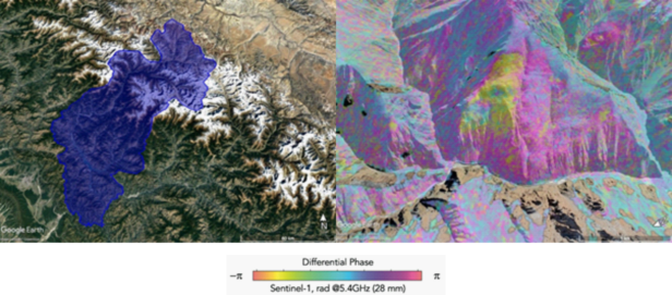
Satellite differential radar interferometry, i.e., DInSAR (link), allows us to retrieve surface displacement information over large regions and with unprecedented accuracies. This technique exploits the phase difference between multi-temporal images captured by satellite radars over the same region, allowing for the generation of surface displacement maps over large areas. The surface displacement is measured along the instrument line-of-sight (LOS), with accuracies that can reach millimeters depending on the target of investigation and quality of the satellite imagery. Systematic acquisitions are available since the early 90’s, allowing to perform back analyses and identify long-term trends. We exploit this method in different areas of the world, in order to study the spatial and temporal evolution of mass movements. These data are the base for scientific advance in understanding the pre-conditioning and triggering factors of alpine mass movements, as well as to perform quantitative evaluations on hazard potential.

Surface displacements from Digital Image Correlation
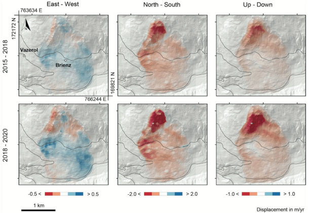
Digital Image Correlation (DIC) is a method allowing to track displacements by comparing pixel groups in multi-temporal imagery. The DIC strategy has been initially adopted to study rapid flow of glaciers; however, this technique is nowadays increasingly used for the investigation of slope instabilities and landslide events. We develop DIC tools (link) and apply the technique in difference case scenarios, relying on data acquired from multiple sensors, mainly optical and radar, and from different platforms (ground-based, airborne, and/or spaceborne).

Operational monitoring of mass movements in complex scenarios
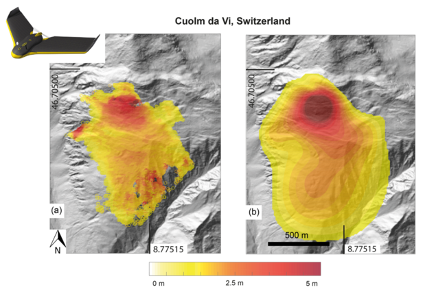
New satellite missions are aimed to provide data with revisit times of few days over the same area. This opens the possibility to develop continuous monitoring programs at regional and local scales. Despite, in complex scenarios this increase in spatial and/or temporal resolution might be not enough for a full characterization of mass movements. Moreover, intrinsic limitations may affect the accuracy of satellite measurements and thus provide incomplete and/or misleading information. To cope with these issues, we complement satellite information with other datasets, as for example ground-based radar acquisitions and high-resolution optical imagery and digital elevation models. We also develop ad-hoc data acquisition and processing strategies aimed at increasing the understanding complex scenarios.
