27.04.2023 | Logbook
Author
SLF-scientists Joel Caduff and Yves Bühler trained scientists and practitioners in drone-based snow depth mapping in the Kyrgyz mountains.
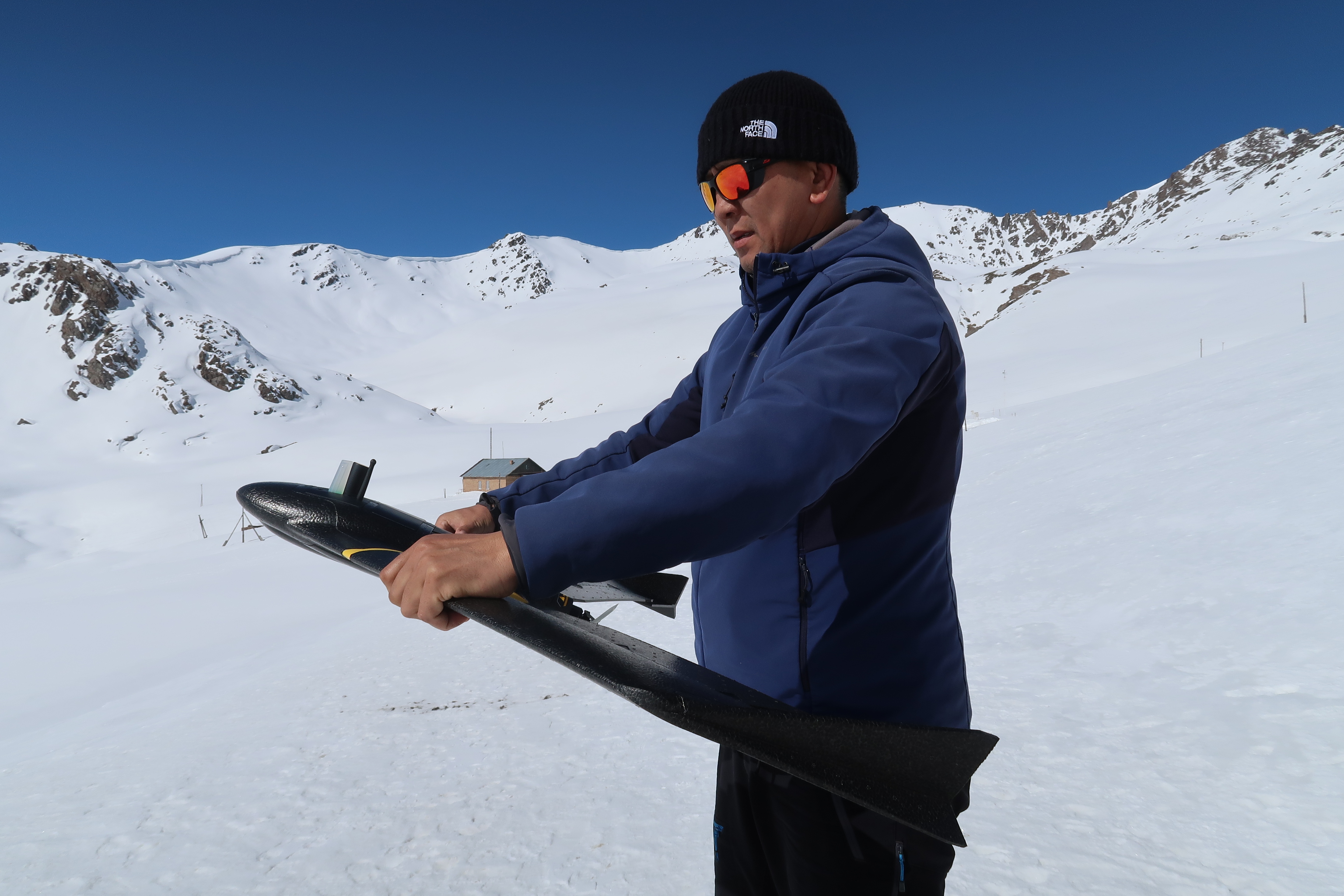
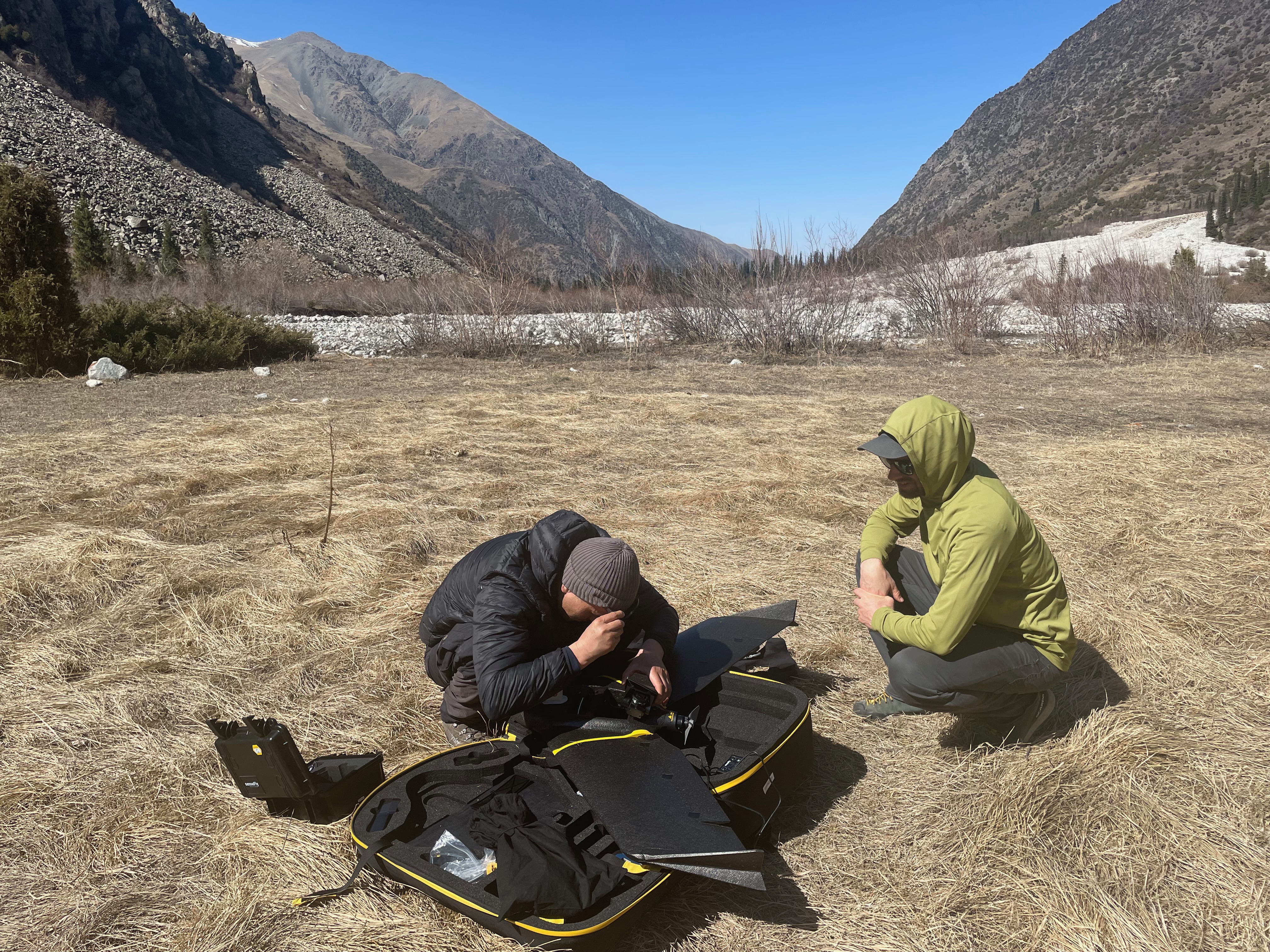
After packing a lot of equipment including ski touring sets and an eBee-X drone, we boarded the plane to Istanbul on March 29th and then to Biskek, the capital of Kyrgyzstan. There our project partner Sultan Bekelov from the Kyrgyz Hydrometeorologcal Agency (Kyrgyz Hydromet) picked us up and drove us to a hotel for a good sleep after the 14 hours trip. The next morning, we visited the Kyrgyz Hydromet Headquarters and the Central Asian Institute of Applied Geosciences. After a lot of tea with the directors of the institutes we demonstrated the eBee X drone, originally developed by a spin-off company from ETH Lausanne, to the staff. We could see their excitement for flying this new toy immediately, and they were very eager to assemble it.
This trip to Kyrgyzstan followed up on a snow monitoring study tour to Davos last December organized for Kyrgyz colleagues under the auspices of the recently established WMO ‘Snow Monitoring Competence Centre, Davos’ (SMCC). During this week first drone training and theory sessions took place.
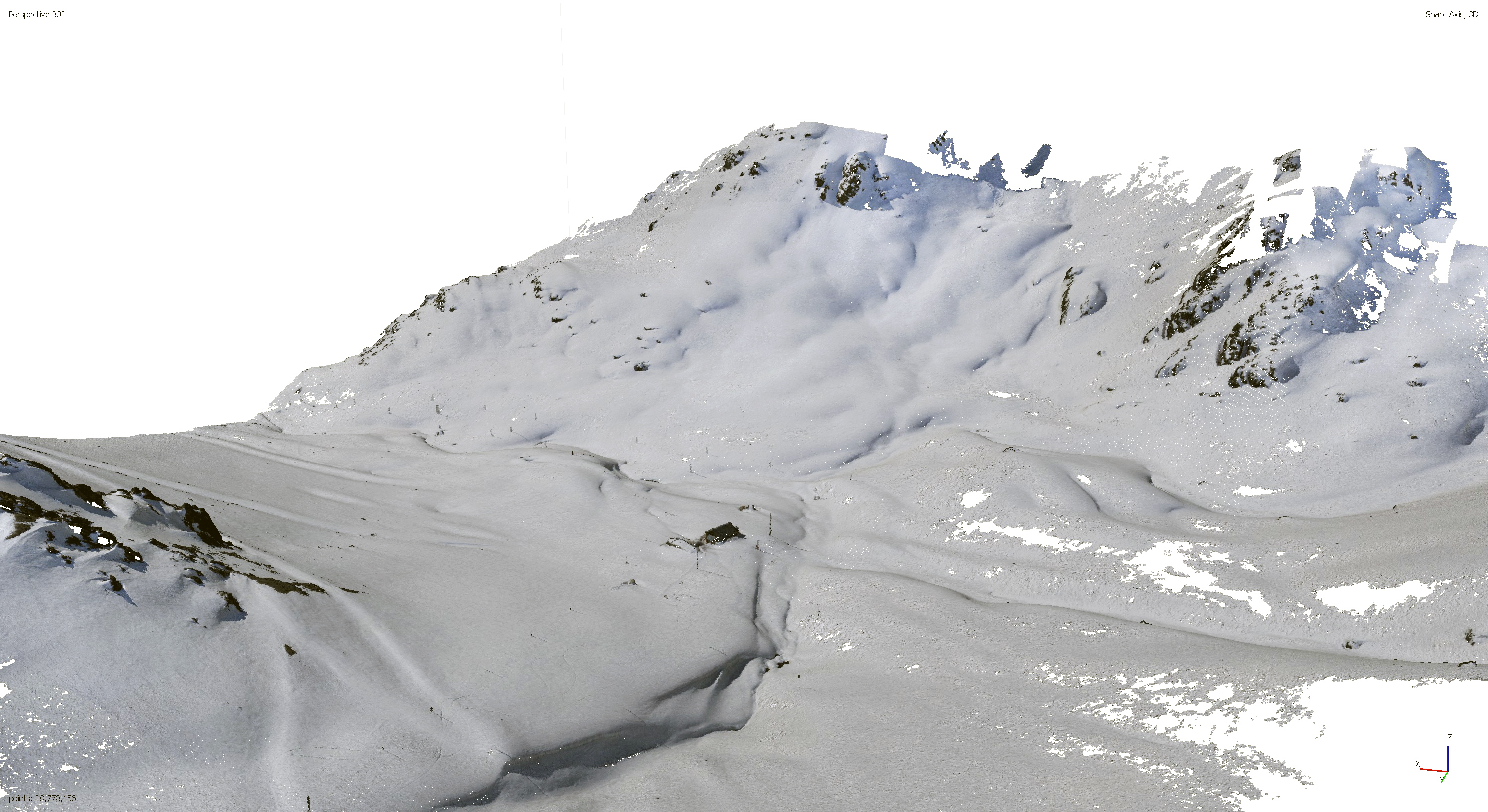
Our Trip was funded within a project by the Swiss Development Cooperation Agency SDC (CROMO-ADAPT). The method established at SLF could help to acquire valuable measurements along elevation transects in the Tien Shan mountain range, the “divine mountains”. They range from Uzbekistan in the west to China in the east and are one of the UNESCO natural world heritage sites. In this remote area only isolated meteo stations and in situ snow measurements exist today. The drone eBee X can help to get more detailed and reliable information.
CROMO-ADAPT colleague Sultan Belekov from Kyrgyz Hydromet launches the drone! (Video: Joel Caduff-Fiddes / SLF)
Too-Ashuu pass 3400 m a.s.l.
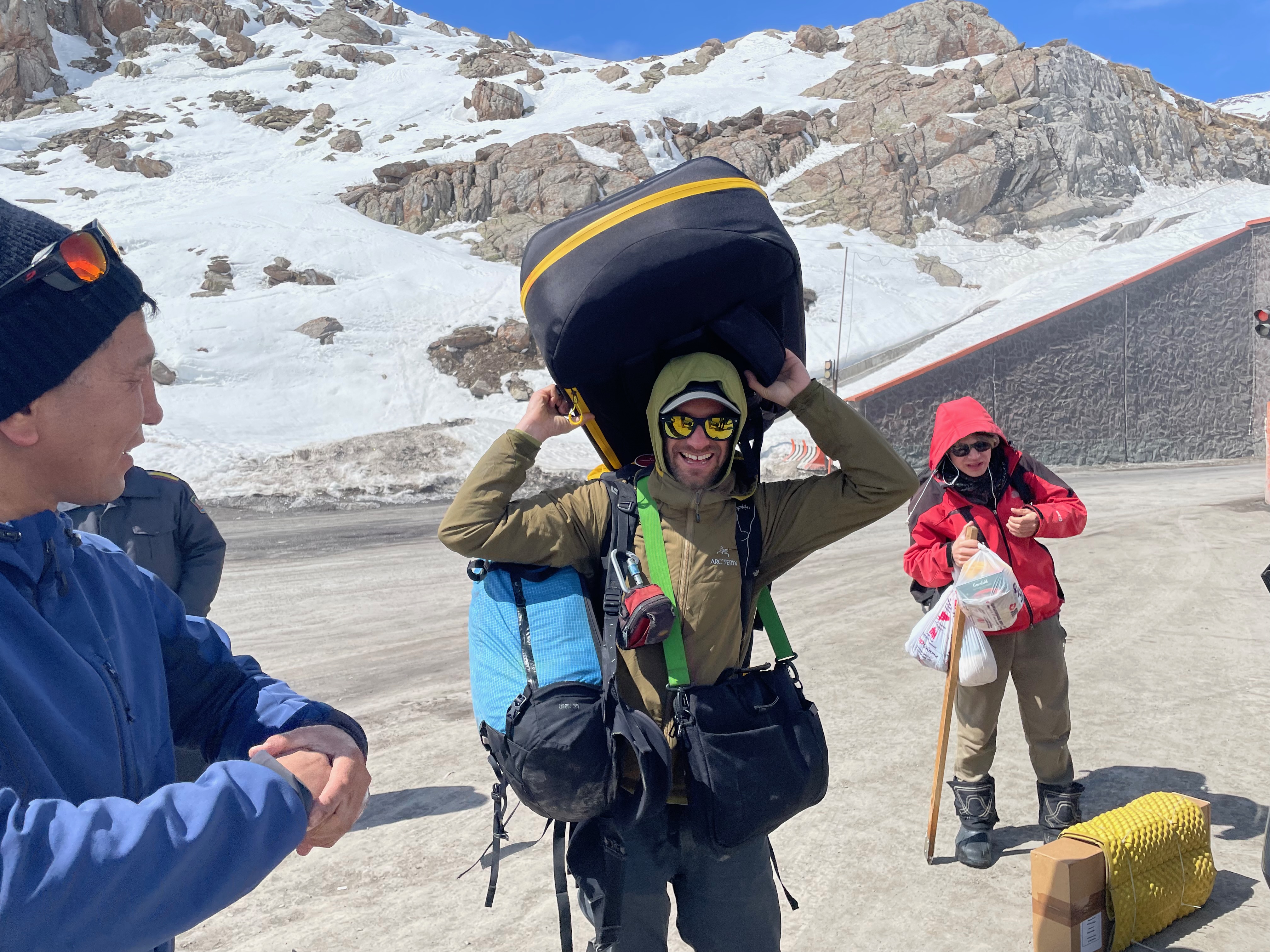
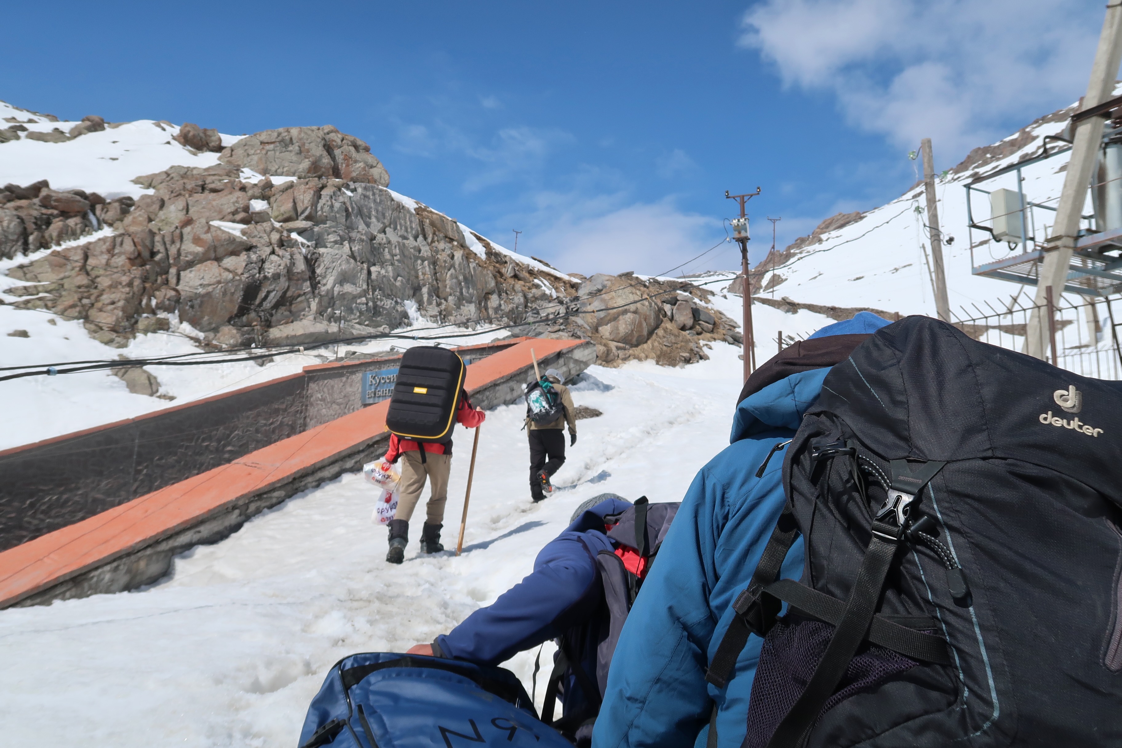
After a short sleep we left Bishkek for the Kyrgyz Hydromet station on the Too-Ashuu pass early next morning. This important connection between the capital and the city of Osh in the south, is a major transport route. Because of its high altitude, snow avalanches are a major problem for road safety. From the tunnel portal to the station, we had to carry our luggage through a very soft spring snow cover, making us disappear several times up to the hips. Fortunately, the station staff was helping us carrying all the equipment.
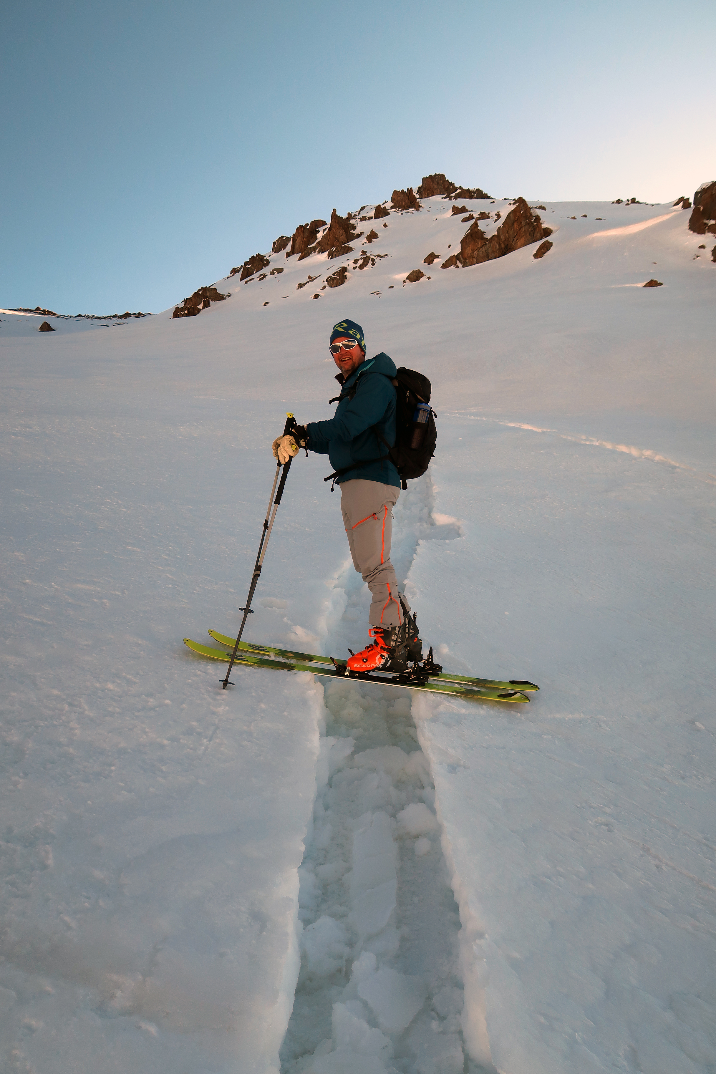
The permanent staff of the station Too-Ashuu has been measuring meteo parameters including snow profiles carefully since the soviet times in the 1960s. After arriving at the station, we could not wait to get on our skis and walk up the summit of the old pass road not in use anymore at an elevation of 3600 m a.s.l. The conditions were quite arctic, a lot of wind, foggy and very cold. The skiing back down to the station was “very big turn powder” meaning wet spring snow where you break down to the ground. The next day the Kyrgyz scientists did the first drone flight under our instructions. Not easy to start at this elevation but we were successful!
Yves skiing down in “big turn powder” (Video: Joel Caduff-Fiddes / SLF)
However, we realized that the quality of the freely available SRTM (Shuttle Radar Topography Mission) elevation model is really insufficient in high mountain areas, and we were happy to have a ground sensor on the drone, detecting if it flew too close to the ground. Thanks to the high quality swisstopo elevation models we use in Switzerland, this problem was new for us and makes the flight planning much more demanding. On the other hand, there are no regulations for drone flying in Kyrgyzstan which is a big advantage compared to Switzerland now.
The next day we got on skis again and climbed up to a nearby peak to an elevation of 3960 m a.s.l to bury one of Joel’s temperature loggers brand “SLF”, developed by Martin Hiller who retired recently. After skiing back on perfect spring snow, we packed our luggage and drove down to the high plateau of Suusamyr (2300 m a.s.l) on the southern side of the pass. There we did a drone flight over perfectly flat, snow-covered terrain. So, we did not have to be afraid of the bad SRTM elevation values. Then we returned back to Biskek burying a few more ‘Hiller’ loggers along the way.

National park Ala Archa
The next trip was to Ala Archa National Park just one hour south of Bishkek. This high alpine glaciated valley beautifully shrouded in central Asian Juniper (‘Archa’) is the site of many glacier studies and is the main source of water for Bishkek city and surrounding agriculture lands. We were cleared for first flights in the park despite an imminent visit of the vice-president, the Kyrgyz are really relaxed people! The initial survey site identified from google earth proved challenging with again inaccurate SRTM data leading to an aborted flight and heavy tail winds caused a ‘hard’ landing as Yves called it! Superficial body damage gave the opportunity to train our team in an essential eBee skill - gaffer tape repairs.
We relocated to a more suitable location to a site with great snow monitoring potential near to the local Bishkek ski slopes (Fig 8). The only stress here was a pair of circling eagles - although they didn't seem too bothered by our eBee. Nonetheless the pilot was ready with the bird evasion maneuver - another key eBee skill. With this final site we were able to establish three good snow monitoring sites for repeat surveys covering a wide range of climate, elevation and also application and we are convinced that our Kyrgyz colleagues are ready to go fly alone.
The CROMO-ADAPT project
CROMO-ADAPT (Cryosphere Observations and Modelling for Adaptation in Central Asia) is the latest phase of over a decade of cryosphere monitoring projects in the region led by Martin Hoelzle at the University of Fribourg. The focus has until now been on glacier monitoring, this phase extends the monitoring to seasonal snow and permafrost with the addition of the SLF as a partner. CROMO-ADAPT is mainly working in Tajikistan and Kyrgyzstan, as these are the water tower countries of the region, but also establishes collaborations with other local scientists and practitioners. We are working with scientists, government employees and decision makers through study exchanges, summer schools and joint expeditions. They all benefit from improved monitoring of the cryosphere. Joel is leading the SLF side of the project and is really happy to be collaborating with Yves and the alpine remote sensing group on this important drone based activity. There are huge needs in the region related to both mountain hazards and water resources, particularly under the dual challenges of climate change and rapid infrastructure and society changes.
")
Image 1 of 8
Departure towards the station (Photo: Yves Bühler / SLF)
")
Image 2 of 8
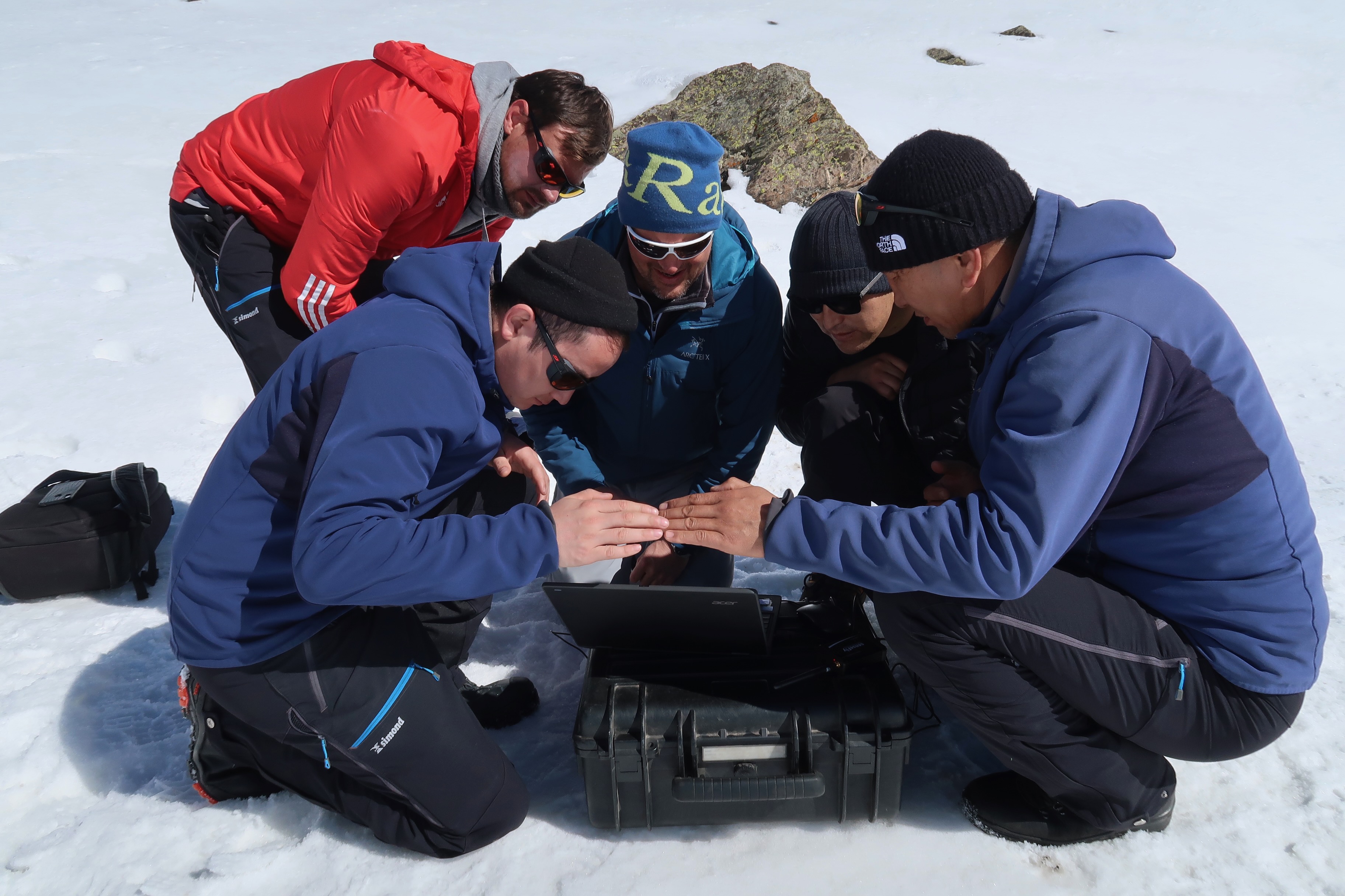
Drone-Control-Tower: following the flight path of the drone on the screen (Photo: Joel Caduff-Fiddes / SLF)
")
Image 3 of 8
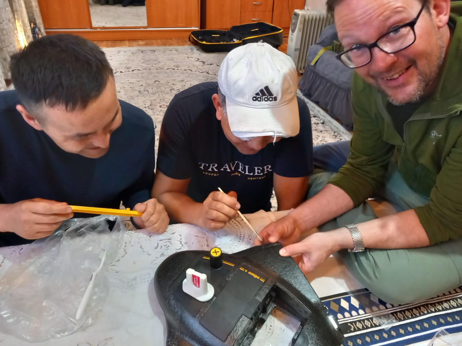
Yves delivering eBee course ‘Module 10’ – “repairs from field damage”! (Photo: Joel Caduff-Fiddes / SLF)
")
Image 4 of 8
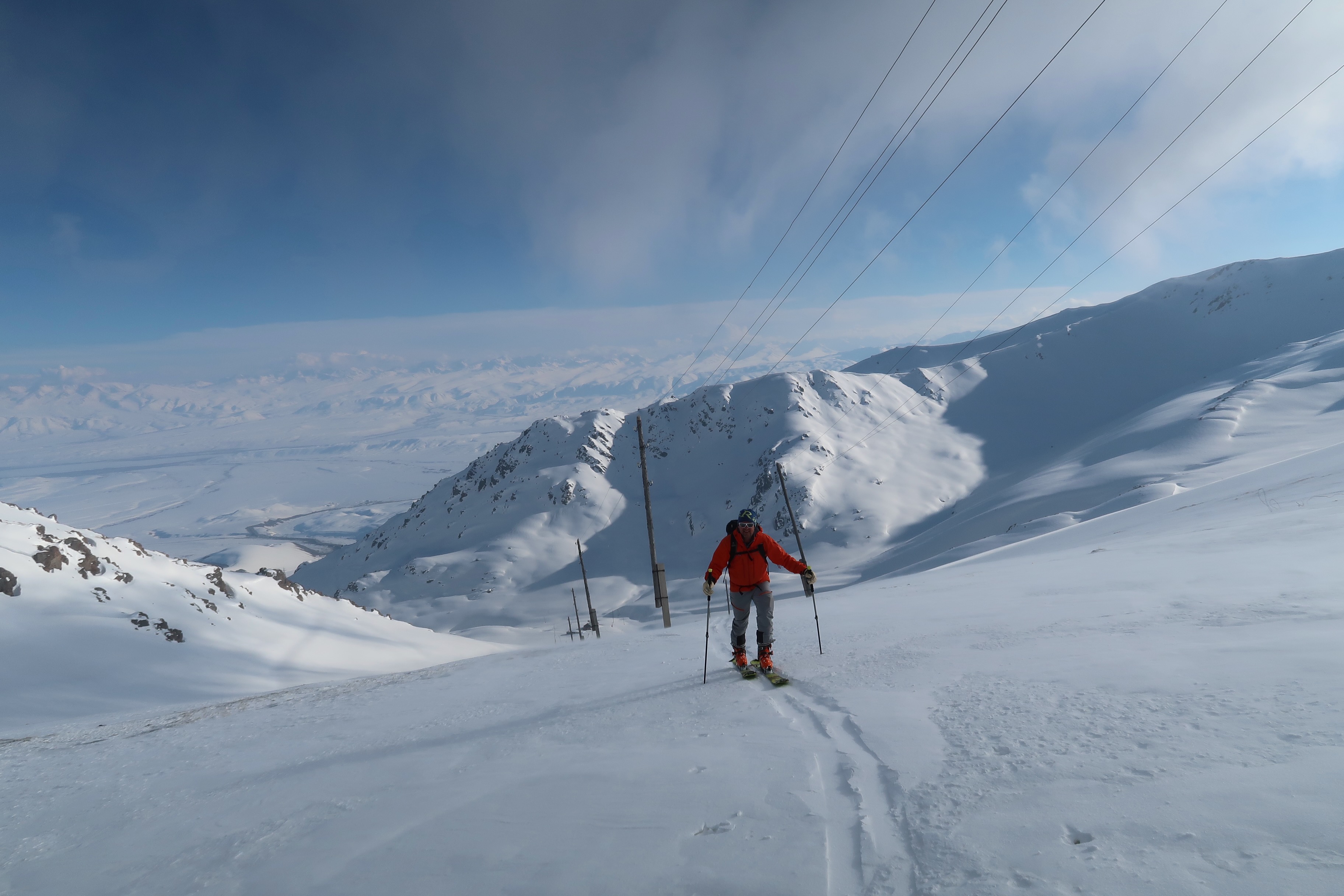
Yves on the way up – thankfully on a re-frozen snowpack ... (Photo: Joel Caduff-Fiddes / SLF)
")
Image 5 of 8
Snow profiles are done daily at Too-Ashuu pass station led by chief Hydromet monitor Iurii Novomlintsev (foreground) – still using original soviet era methods. (Photo: Yves Bühler / SLF)
")
Image 6 of 8
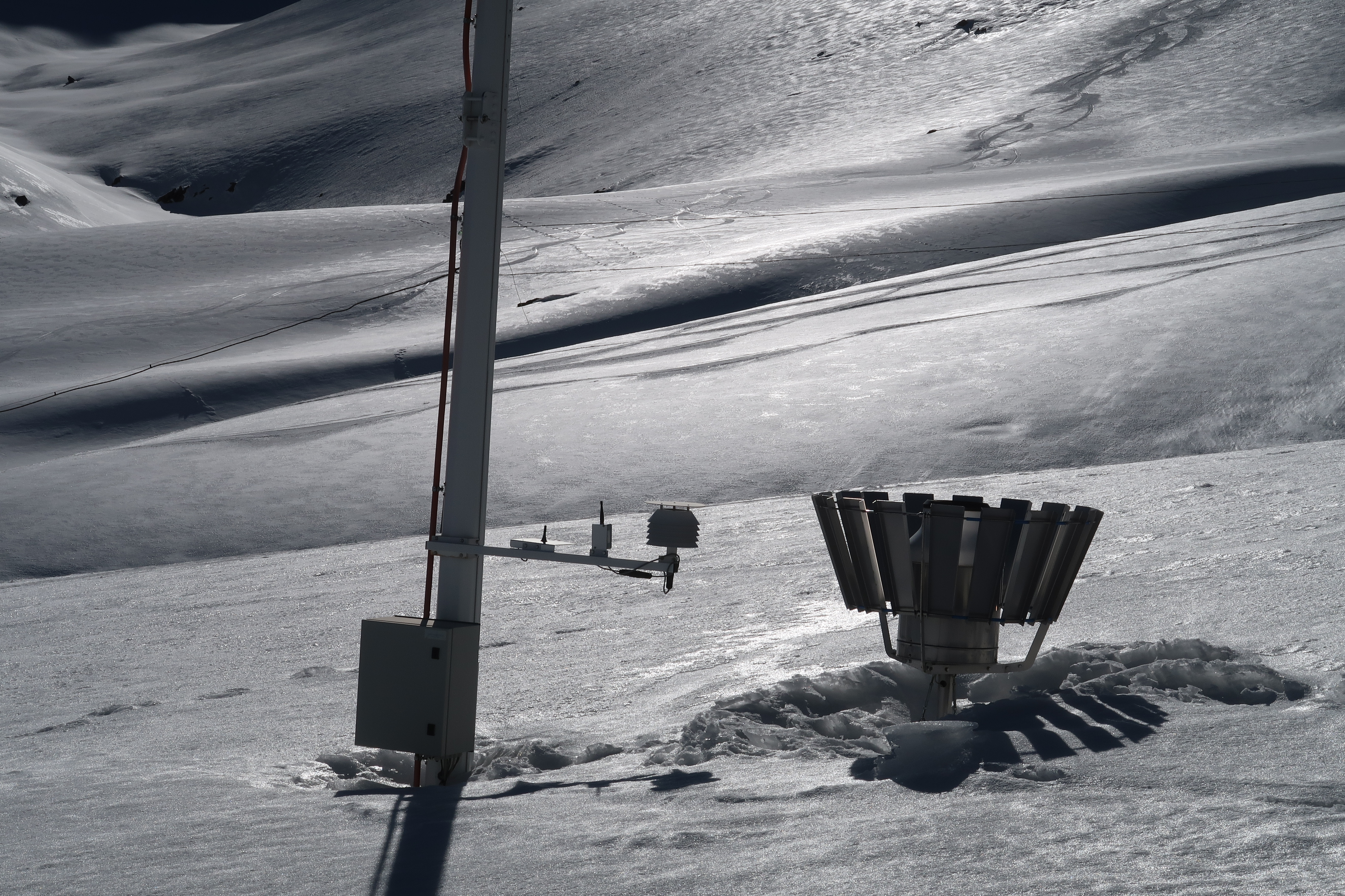
Heard of undercatch? This pluvio at Too-Ashuu suffers from overcatch! Built too low it collects drifting snow during the winter. A typical problem in the region where infrastructure investments are too often disconnected from capacity building. (Photo: Yves Bühler / SLF)
")
Image 7 of 8
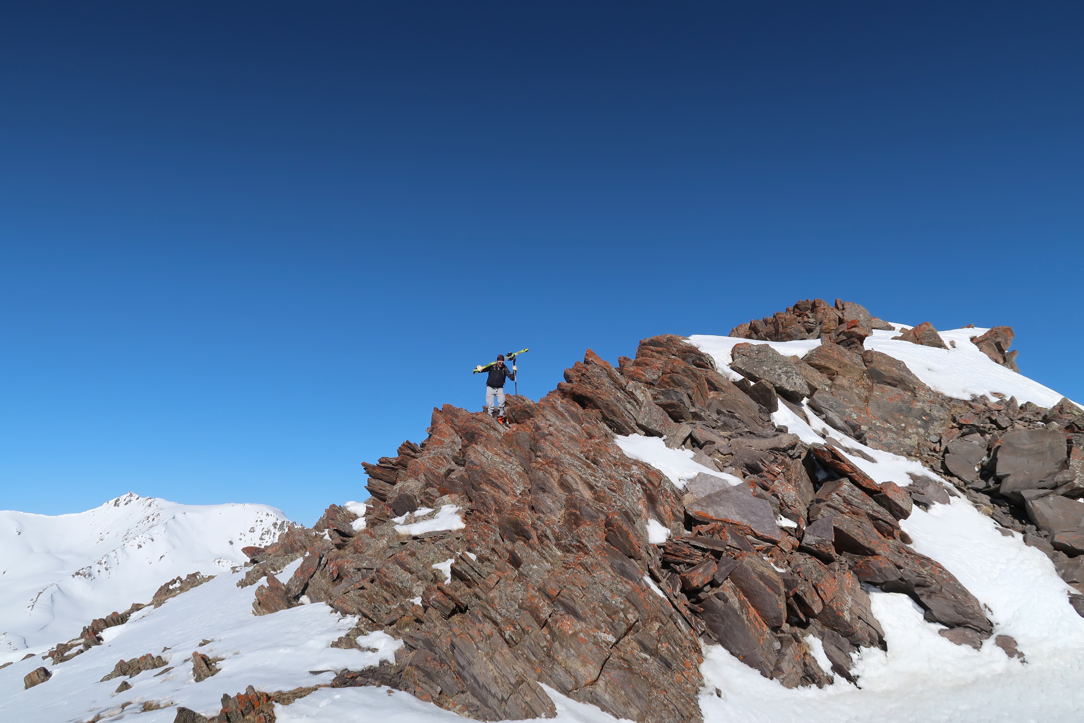
Yves on the way back from Too-Ashuu ridge. (Photo: Joel Caduff-Fiddes / SLF)
")
Image 8 of 8
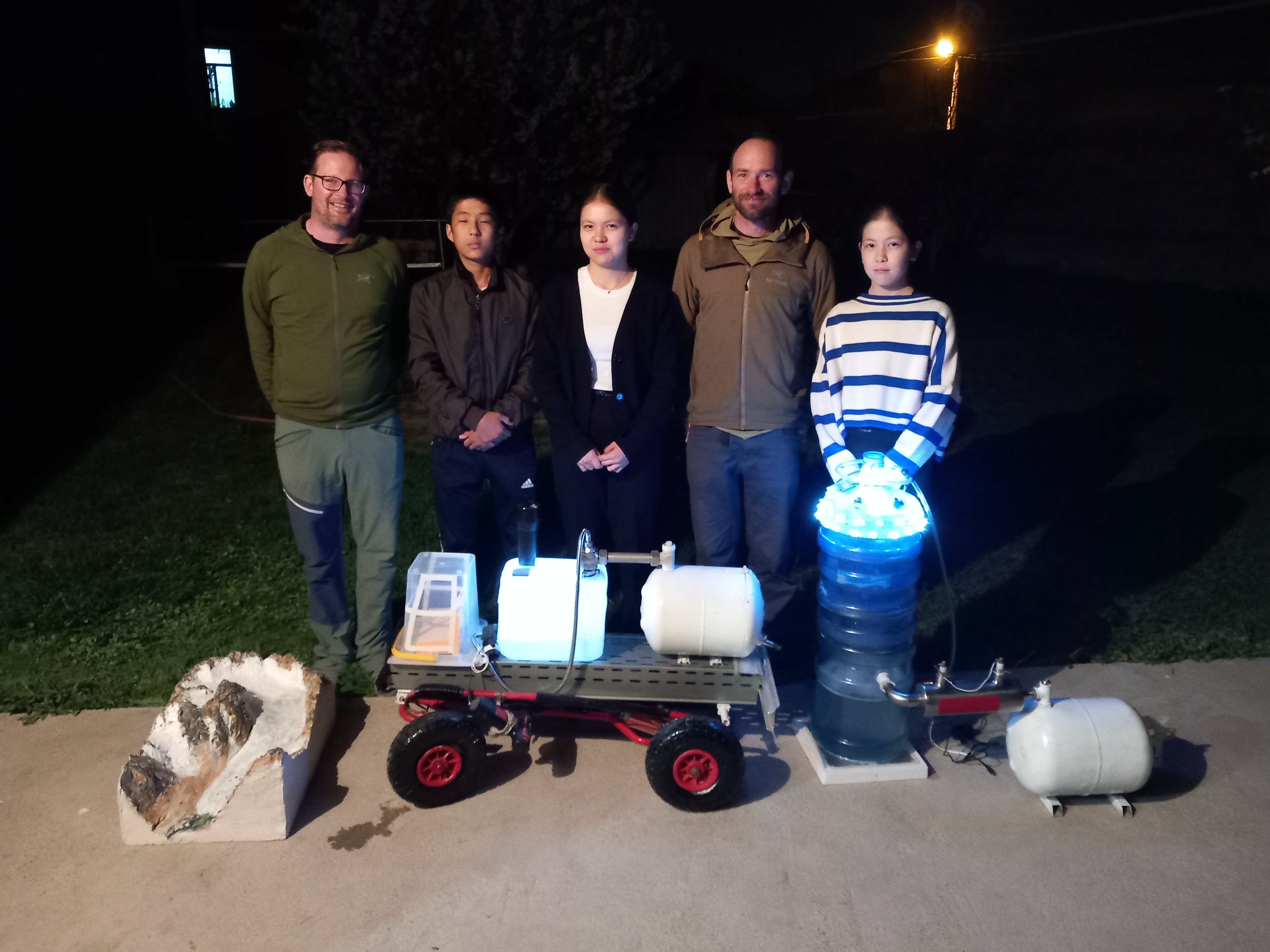
On our final evening we were treated to a presentation by young environmental science researchers (our colleagues' kids)! They present their approach to clean the air with water filters (Biskek has a hugh smog problem) developed in their science class project at school. (Photo: Sultan Bekelov, Kyrgyz Hydromet)
Joel and Yves are convinced, that the SLF has many of the tools required to address these challenges under its roof, especially with successful inter research unit collaborations such as this Kyrgyz mission. After 9 days of very intense exchange, we landed tired and happy in Zurich to catch the train back to Davos. Joel will be continuing the support by expanding the monitoring sites with snow-off flights this coming September. Yves will be back in Central Asia (Uzbekistan) in June, organizing a workshop on Alpine Remote Sensing where the Kyrgyz partners will also participate.