Monitoring glaciers in the Val Ferret (Italy) with high resolution SAR imagery
2023
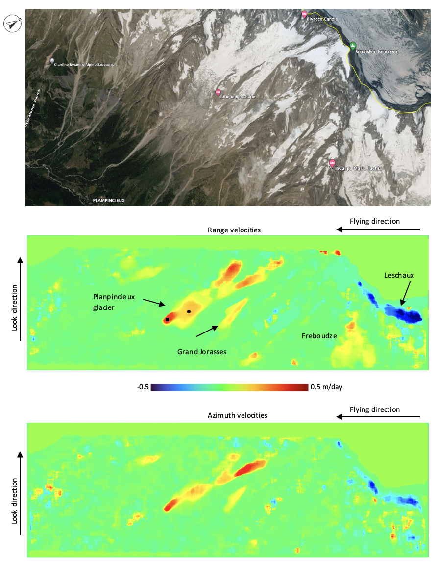
This pilot activity proposed by SLF in agreement with Fondazione Montagna Sicura (FMS, https://www.fondazionemontagnasicura.org/) is aimed at identifying and measuring the surface changes and displacements affecting on the Planpincieux glacier, Val Ferret, Italy, by using very high-resolution satellite synthetic aperture radar (SAR) datasets.
SLF proposed the use of the commercial satellite constellation ICEYE (http://www.iceye.com), due to high spatial and temporal resolution nowadays achievable with this system and based on prior experience performed with such data over alpine areas.
The activity consists in: (i) tasking ad-hoc on the Planpincieux Glacier ICEYE acquisitions; (ii) applying radiometric calibration and topographic correction of the raw SAR imagery; (iii) testing change detection capabilities; (iv) testing Digital Image Correlation (DIC) techniques to measure surface displacements.